
Image: Doaks-Stand

Size of this preview: 794 × 599 pixels. Other resolutions: 318 × 240 pixels | 2,272 × 1,715 pixels.
Original image (2,272 × 1,715 pixels, file size: 36 KB, MIME type: image/png)
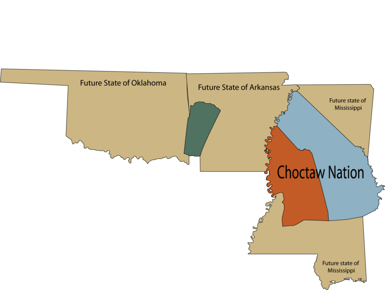
Description: Map of U.S. states Arkansas, Mississippi, and Oklahoma in relation to Choctaw land ceded to the U.S. According to the Treaty of Doak's Stand the area in orange was ceded to the United States, and the area in green was ceded to the Choctaw nation.
Title: Doaks-Stand
Credit: Own work
Author: Rob (talk)
Usage Terms: Public domain
License: Public domain
Attribution Required?: No
Image usage
The following page links to this image:

All content from Kiddle encyclopedia articles (including the article images and facts) can be freely used under Attribution-ShareAlike license, unless stated otherwise.