
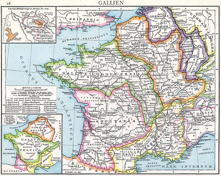
Image: Droysens Hist Handatlas S16 Gallien

Size of this preview: 752 × 599 pixels. Other resolutions: 301 × 240 pixels | 2,755 × 2,196 pixels.
Original image (2,755 × 2,196 pixels, file size: 1.81 MB, MIME type: image/jpeg)
Description: Alte historische Karte Galliens unter Römischer Herrschaft aus dem Historischen Handatlas von Droysen, 1886
Title: Droysens Hist Handatlas S16 Gallien
Credit: Gustav Droysens Allgemeiner historischer Handatlas in 96 Karten mit erläuterndem Text Bielefeld [u.a.]: Velhagen & Klasing 1886, S. 16
Author: Gustav Droysen
Usage Terms: Public domain
License: Public domain
Attribution Required?: No
Image usage
The following 2 pages link to this image:

All content from Kiddle encyclopedia articles (including the article images and facts) can be freely used under Attribution-ShareAlike license, unless stated otherwise.