
Image: DuluthMapRevised
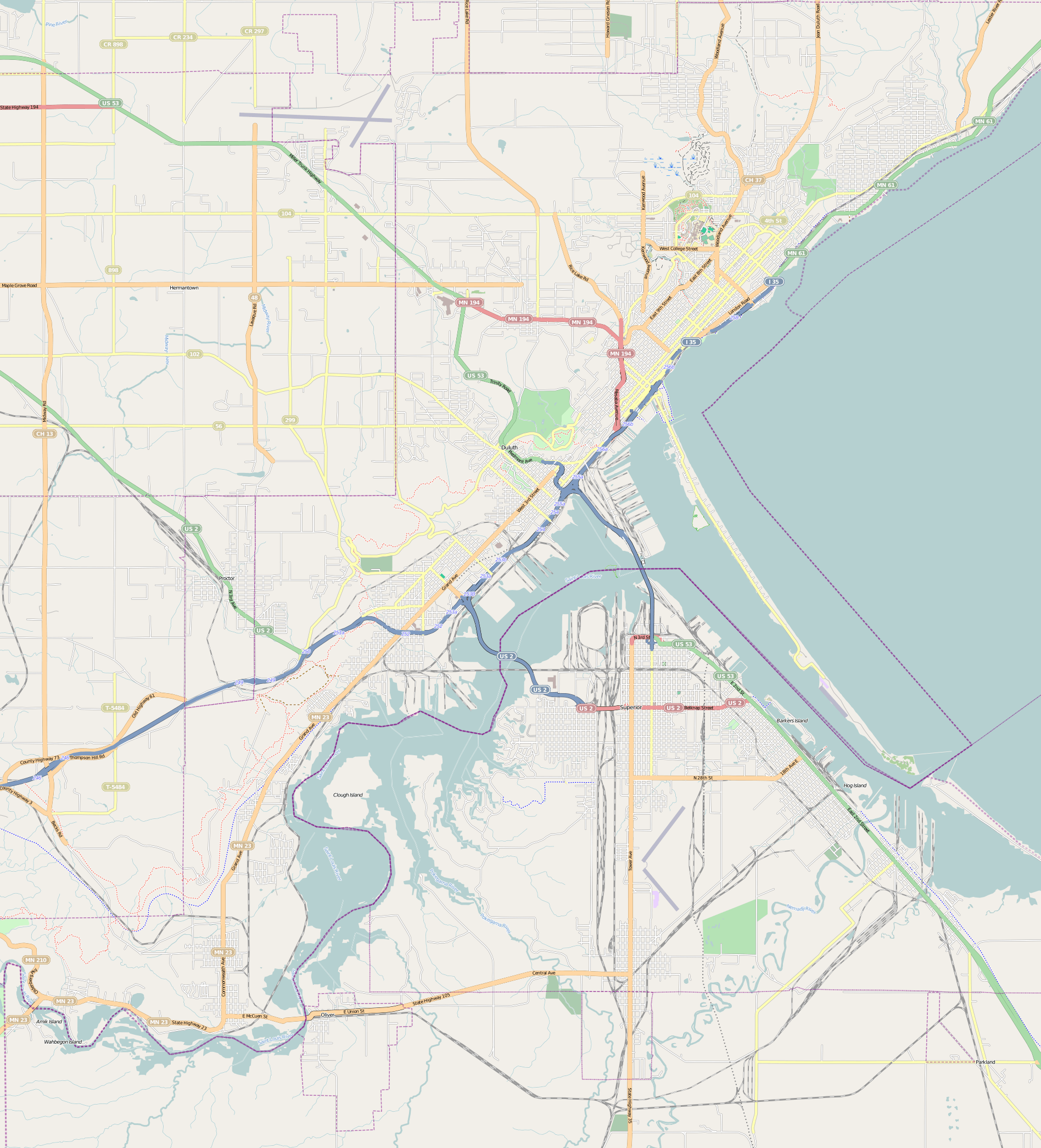
Description: This map of Duluth and vicinity was created from OpenStreetMap project data, collected by the community. This map may be incomplete, and may contain errors. Don't rely solely on it for navigation.
Title: DuluthMapRevised
Credit: openstreetmap.org
Author: Dulufoto
Permission: OpenStreetMap data and maps are licensed under the Creative Commons Attribution-ShareAlike 2.0 license (CC-BY-SA 2.0). This file is licensed under the Creative Commons Attribution-Share Alike 2.0 Generic license. You are free: to share – to copy, distribute and transmit the work to remix – to adapt the work Under the following conditions: attribution – You must give appropriate credit, provide a link to the license, and indicate if changes were made. You may do so in any reasonable manner, but not in any way that suggests the licensor endorses you or your use. share alike – If you remix, transform, or build upon the material, you must distribute your contributions under the same or compatible license as the original. https://creativecommons.org/licenses/by-sa/2.0 CC BY-SA 2.0 Creative Commons Attribution-Share Alike 2.0 truetrue
Usage Terms: Creative Commons Attribution-Share Alike 2.0
License: CC BY-SA 2.0
License Link: https://creativecommons.org/licenses/by-sa/2.0
Attribution Required?: Yes
Image usage
The following 28 pages link to this image:
- Bergetta Moe Bakery
- Bridge 5757
- Bridge L6113
- Bridge L8515
- Chester Terrace (Duluth, Minnesota)
- DeWitt–Seitz Building
- Downtown Duluth
- Duluth Armory
- Duluth Civic Center Historic District
- Duluth Masonic Center
- Duluth Public Library (historic)
- Endion station
- Hartley Building
- Kitchi Gammi Club
- Lester River Bridge
- Lester River Fish Hatchery
- Lincoln Branch Library
- Mayflower (scow)
- Munger Terrace
- Oliver G. Traphagen House
- SS Thomas Wilson
- SS William A. Irvin
- St. Mark's African Methodist Episcopal Church
- Stewart Creek Bridge
- U.S. Army Corps of Engineers Duluth Vessel Yard
- USS Essex (1874)
- Wirth Building
- YWCA of Duluth
