
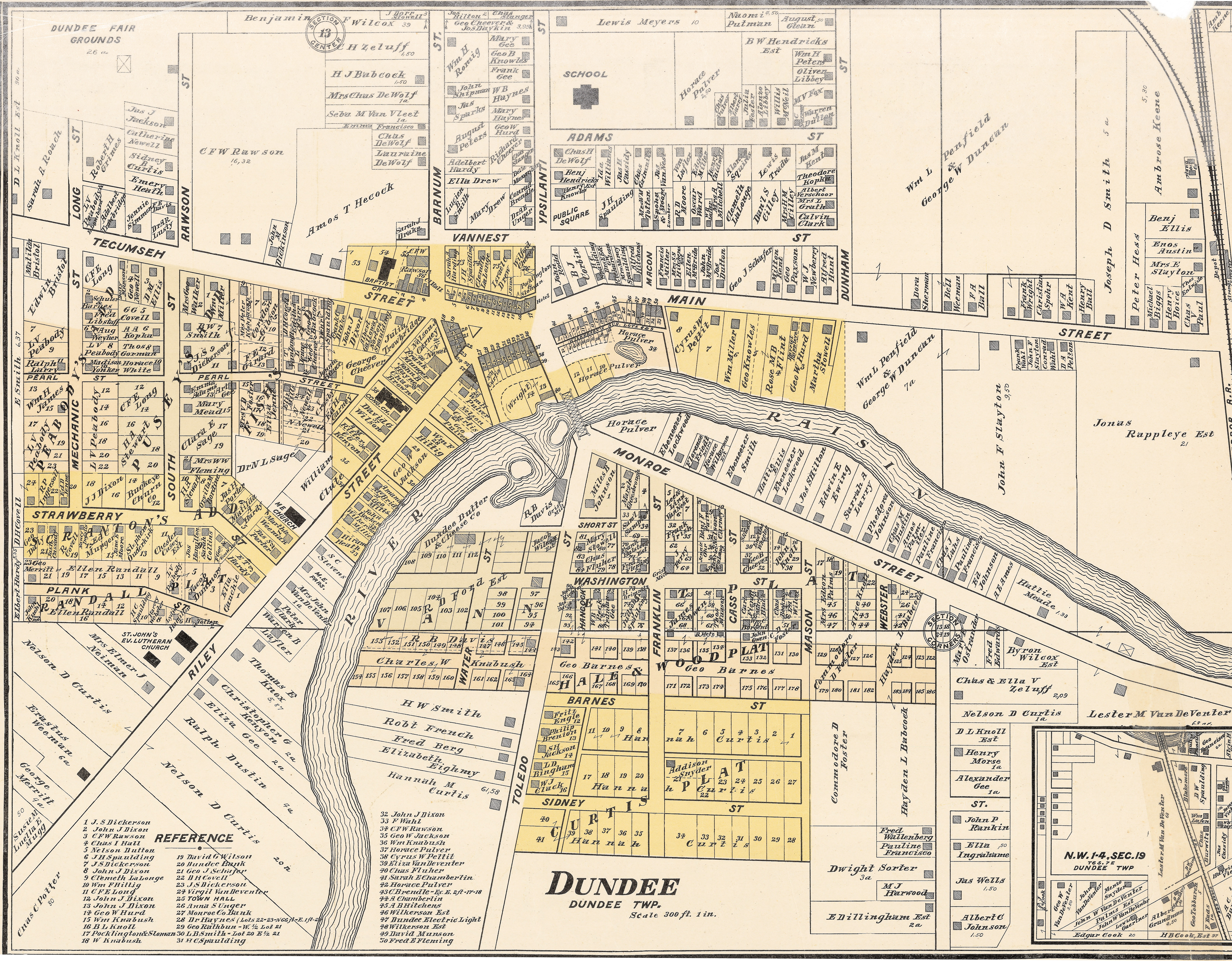
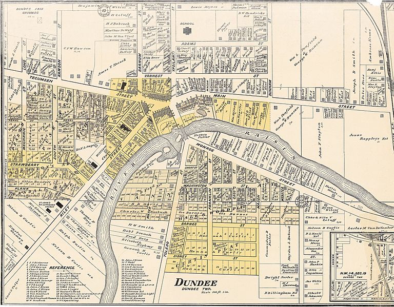
Image: Dundee, Michigan. Detail from Map of Monroe County 1901
Size of this preview: 768 × 599 pixels. Other resolutions: 308 × 240 pixels | 5,629 × 4,392 pixels.
Original image (5,629 × 4,392 pixels, file size: 7.74 MB, MIME type: image/jpeg)
Description: 1901 cadastral map of Dundee, Michigan showing property lines and major landowners.
Title: Dundee, Michigan. Detail from Map of Monroe County 1901
Credit: Map of Monroe County, Michigan. Carleton, MI: Geo. E. Lang, 1901.
Author: George Earl Lang
Usage Terms: Public domain
License: Public domain
Attribution Required?: No
Image usage
The following page links to this image:

All content from Kiddle encyclopedia articles (including the article images and facts) can be freely used under Attribution-ShareAlike license, unless stated otherwise.