
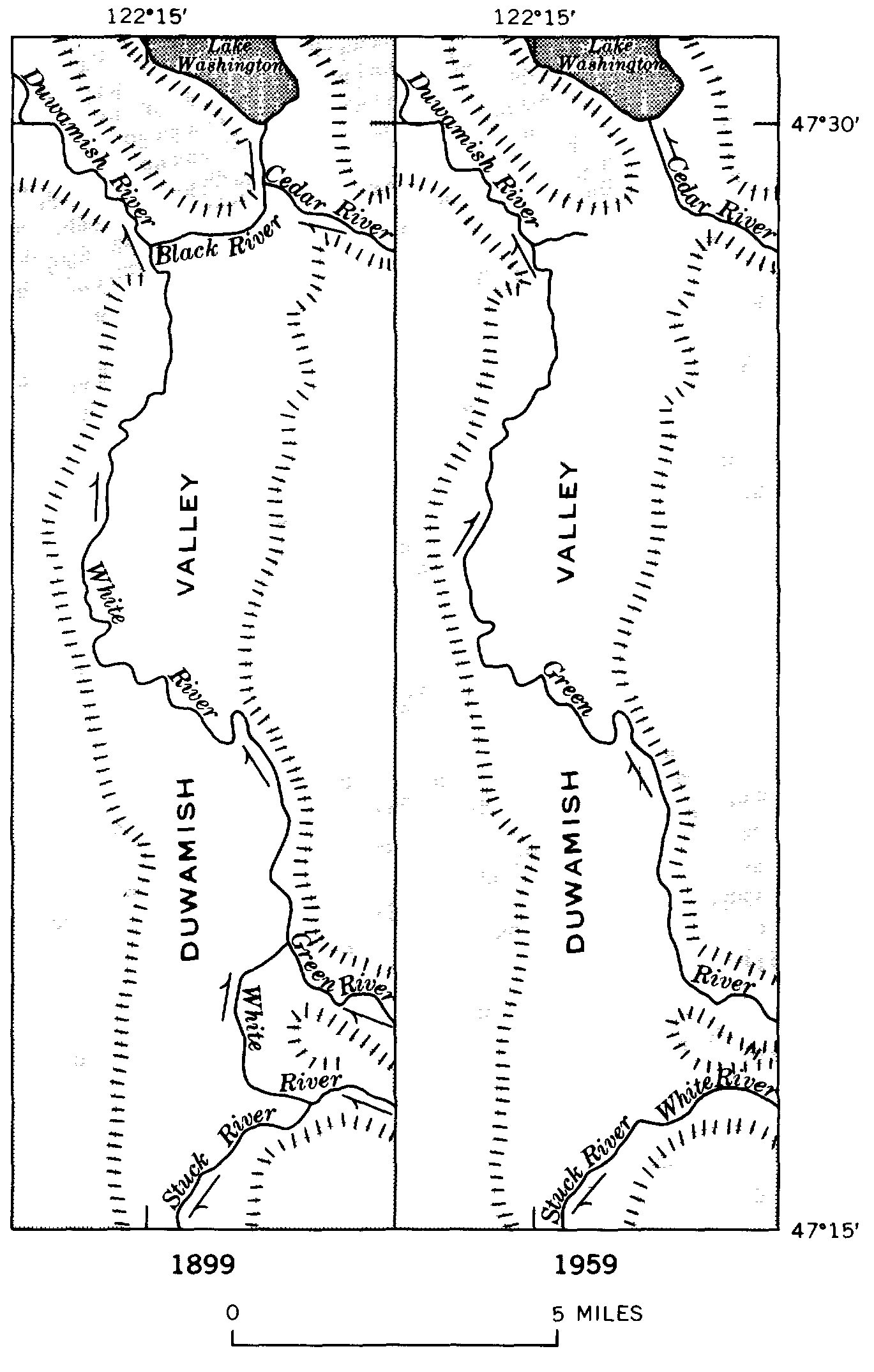
Image: Duwamishvalley1899-1959
Size of this preview: 382 × 600 pixels. Other resolutions: 153 × 240 pixels | 1,369 × 2,149 pixels.
Original image (1,369 × 2,149 pixels, file size: 74 KB, MIME type: image/png)
Description: Maps showing the changes of course and nomenclature of rivers in the Duwamish Valley, 1899-1959.
Title: Duwamishvalley1899-1959
Credit: Geology of the Renton, Auburn, and Black Diamond Quadrangles, King County, Washington. (United State Government Printing Office, Washington: 1970)
Author: Donal R. Mullineaux
Usage Terms: Public domain
License: Public domain
Attribution Required?: No
Image usage
The following 4 pages link to this image:

All content from Kiddle encyclopedia articles (including the article images and facts) can be freely used under Attribution-ShareAlike license, unless stated otherwise.