
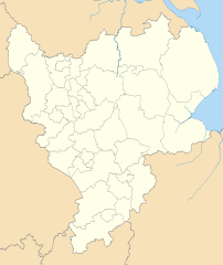
Image: East Midlands districts 2011 map

Size of this PNG preview of this SVG file: 505 × 600 pixels. Other resolution: 202 × 240 pixels.
Original image (SVG file, nominally 1,099 × 1,305 pixels, file size: 1.61 MB)
Description: Map of the East Midlands region showing the administrative districts. Equirectangular map projection on WGS 84 datum, with N/S stretched 165% Geographic limits: West: 2.1W East: 0.4E North: 53.7N South: 51.9N
Title: East Midlands districts 2011 map
Credit: Ordnance Survey OpenData: County boundaries (from Boundary-Line product) Coastline data for Great Britain (from Boundary-Line product)
Author: Nilfanion, created using Ordnance Survey data
Usage Terms: Creative Commons Attribution-Share Alike 3.0
License: CC BY-SA 3.0
License Link: https://creativecommons.org/licenses/by-sa/3.0
Attribution Required?: Yes
Image usage
The following 5 pages link to this image:

All content from Kiddle encyclopedia articles (including the article images and facts) can be freely used under Attribution-ShareAlike license, unless stated otherwise.