
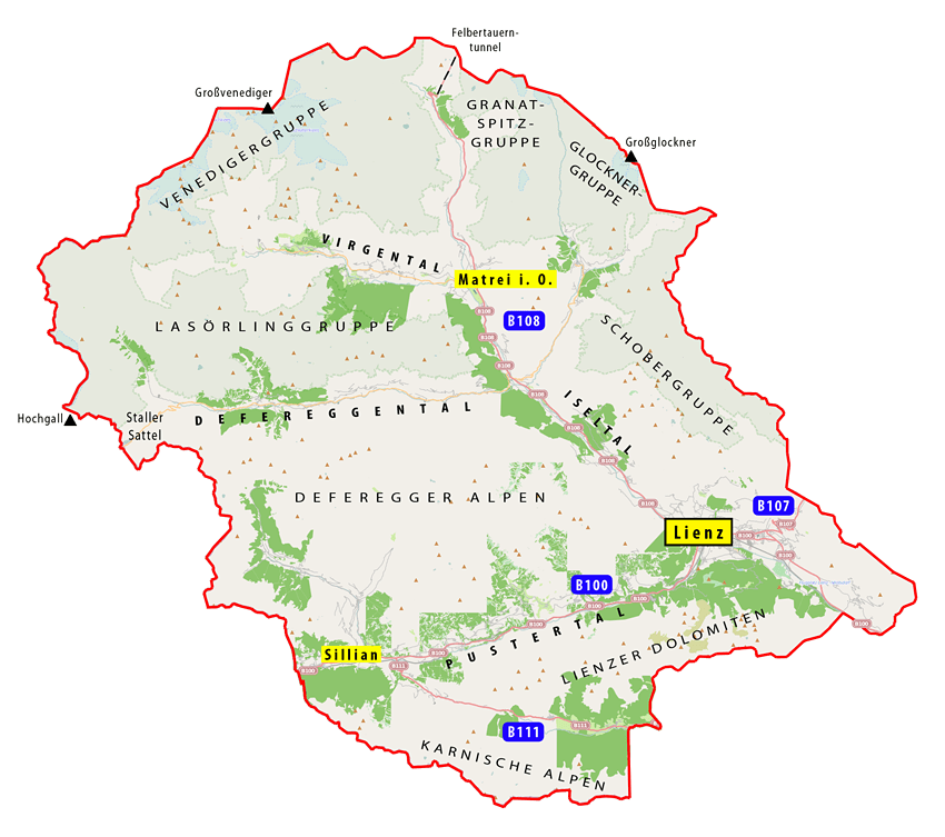
Image: East Tyrol map
Size of this preview: 677 × 600 pixels. Other resolutions: 271 × 240 pixels | 850 × 753 pixels.
Original image (850 × 753 pixels, file size: 114 KB, MIME type: image/png)
Description: Self-created East Tyrol overview map. Base map: www.openstreetmap.org. Geographic datas: Osttirol Bilderreise (BOOKZ - GRAFIK ZLOEBL BUCHDESIGN & -VERLAG © GRAFIK ZLOEBL GmbH, 2011, ISBN 978-3-9503142-1-2).
Title: East Tyrol map
Credit: Own work
Author: Csabaf
Usage Terms: Creative Commons Attribution-Share Alike 3.0
License: CC BY-SA 3.0
License Link: https://creativecommons.org/licenses/by-sa/3.0
Attribution Required?: Yes
Image usage
The following page links to this image:

All content from Kiddle encyclopedia articles (including the article images and facts) can be freely used under Attribution-ShareAlike license, unless stated otherwise.