
Image: Ellis Island 1890 - 1935 NPS map
Size of this preview: 796 × 599 pixels. Other resolutions: 319 × 240 pixels | 1,000 × 753 pixels.
Original image (1,000 × 753 pixels, file size: 467 KB, MIME type: image/jpeg)
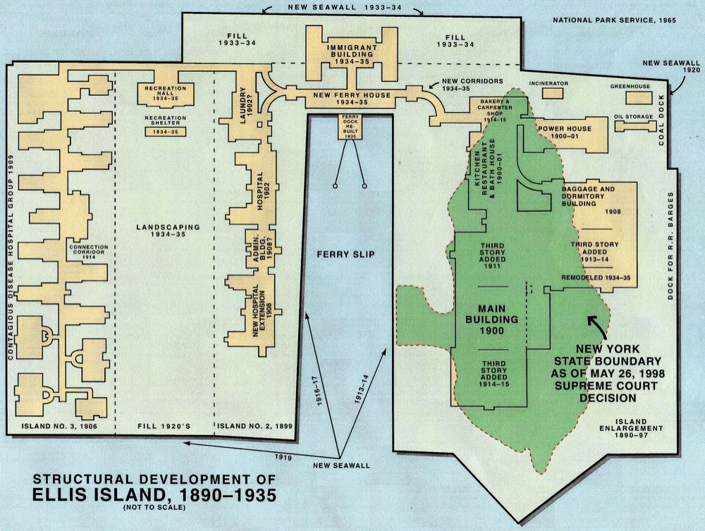
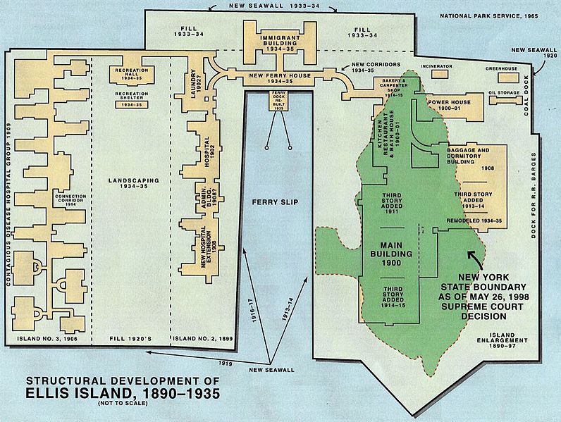
Description: Sketch map of Ellis Island, New York City. Green is the area of the original natural island (only this area is part of New York City, while the man-made rest of the island is part of Jersey City in the State of New Jersey), the rest is all man-made between 1890 and 1935 by land reclamation, using filling material from subway construction, North = upper right corner
Title: Ellis Island 1890 - 1935 NPS map
Credit: https://www.nps.gov/elis/learn/historyculture/maps.htm https://sites.rootsweb.com/~quarantine/EI-maps.htm
Author: National Park Service, United States Department of the Interior
Usage Terms: Public domain
License: Public domain
Attribution Required?: No
Image usage
The following 2 pages link to this image:

All content from Kiddle encyclopedia articles (including the article images and facts) can be freely used under Attribution-ShareAlike license, unless stated otherwise.