
Image: Emergency shoulder use Interstate 4 before Hurricane Irma 3
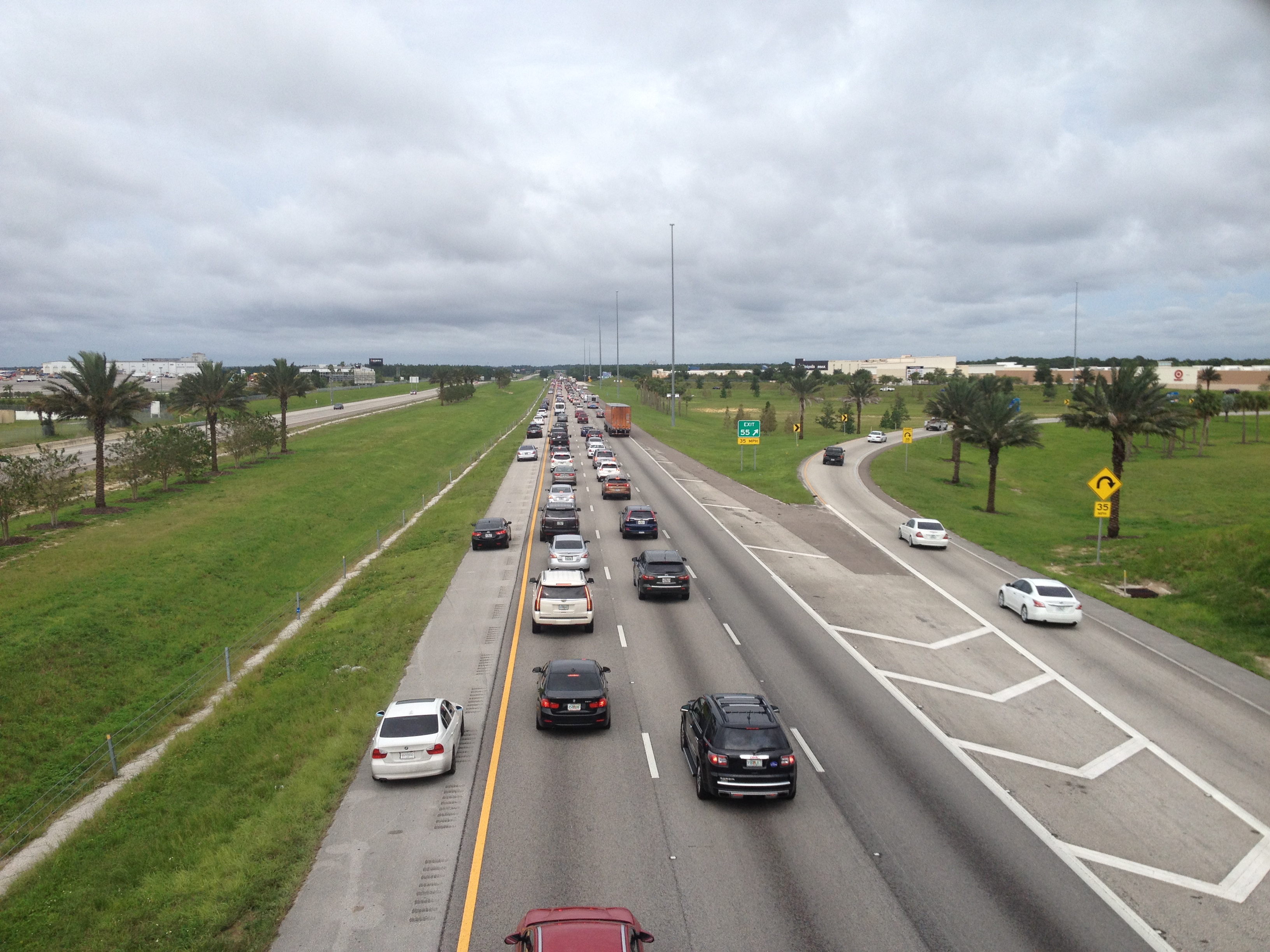
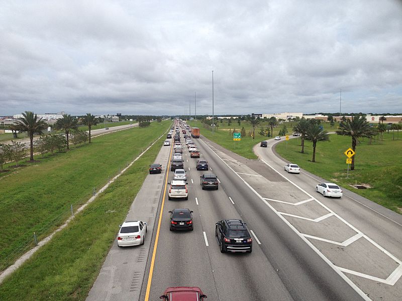
Description: Interstate 4 viewed from the U.S. Highway 27 overpass (Davenport, Florida) on the afternoon of Saturday, September 9, 2017, which was the afternoon before the arrival of Hurricane Irma. The forecast track of Category 4/5 Hurricane Irma had been to make a turn from a westwardly track to a northerly track before making landfall in Florida and for most of the preceding week it was forecast to make landfall near Miami and travel inland up the east coast of Florida, but by late Thursday, as Irma did not begin curving towrds the north, the forecast track up the Florida Peninsula shifted west. By Friday evening, the forecast track was up the west coast, prompting a large volume of evacuees from the Tampa Bay area towards the Orlando area. On Saturday, the Governor authorized the Florida Highway Patrol and Florida Department of Transportation to initiate an emergency shoulder use plan on eastbound I-4 from U.S. Highway 41 in Tampa to State Road 429 on the southern side of the Orlando metropolitan area. The emergency shoulder use plan allowed moving vehicles (except trucks and buses) to use the left shoulder as a travel lane with a speed limit of 40 mph (64 km/h). The emergency shoulder use plan was implemented instead of contraflow.
Title: Emergency shoulder use Interstate 4 before Hurricane Irma 3
Credit: Own work
Author: Andrew Heneen
Usage Terms: Creative Commons Attribution 4.0
License: CC BY 4.0
License Link: https://creativecommons.org/licenses/by/4.0
Attribution Required?: Yes
Image usage
The following page links to this image:
