
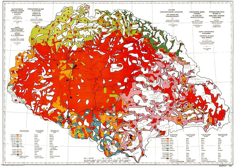
Image: Ethnographic map of hungary 1910 by teleki carte rouge

Size of this preview: 800 × 566 pixels. Other resolutions: 320 × 226 pixels | 4,962 × 3,509 pixels.
Original image (4,962 × 3,509 pixels, file size: 5.18 MB, MIME type: image/jpeg)
Description: Ethnographic map of Hungary, based on the density of population according to the census of 1910. Original scale 1 : 1 000 000. Every square millimeter colored indicates 100 inhabitants. "Carte Rouge" - "Red map" was made for the peace talk in Trianon.
Title: Ethnographic map of hungary 1910 by teleki carte rouge
Credit: Scanned from an original
Author: Paul Teleki (1879-1941)
Usage Terms: Public domain
License: Public domain
Attribution Required?: No
Image usage
The following page links to this image:

All content from Kiddle encyclopedia articles (including the article images and facts) can be freely used under Attribution-ShareAlike license, unless stated otherwise.