
Image: Europe 1783-1792 en

Size of this preview: 800 × 570 pixels. Other resolutions: 320 × 228 pixels | 3,872 × 2,761 pixels.
Original image (3,872 × 2,761 pixels, file size: 441 KB, MIME type: image/png)
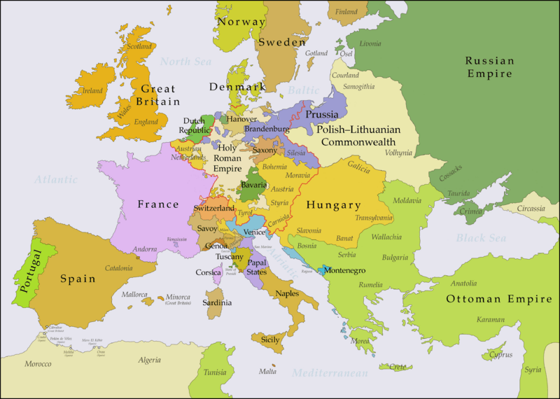
Description: This map shows Europe in the years between the 1783 Russian annexation of Crimea after the Russo-Turkish War of 1768–1774 and the Russian annexation of Yedisan in 1792 at the end of the Russo-Turkish War of 1787–1792. The red line marks the borders of the Holy Roman Empire. The work was created with Inkscape and is mainly based on a map in: Putzger - Historischer Weltatlas, Berlin 1990, 78 pp.
Title: Europe 1783-1792 en
Credit: Own work, based on File:Europe 1748-1766 en.png
Author: Bryan Rutherford
Usage Terms: Creative Commons Attribution-Share Alike 4.0
License: CC BY-SA 4.0
License Link: https://creativecommons.org/licenses/by-sa/4.0
Attribution Required?: Yes
Image usage
The following 4 pages link to this image:

All content from Kiddle encyclopedia articles (including the article images and facts) can be freely used under Attribution-ShareAlike license, unless stated otherwise.