
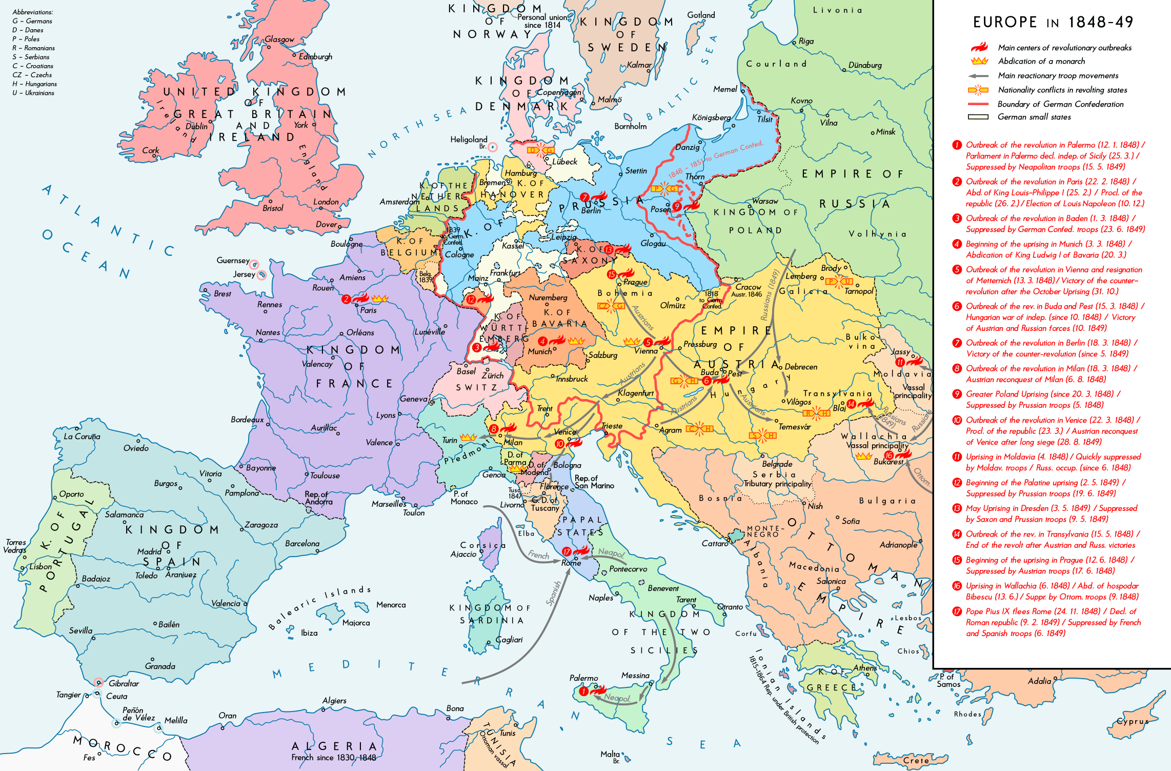
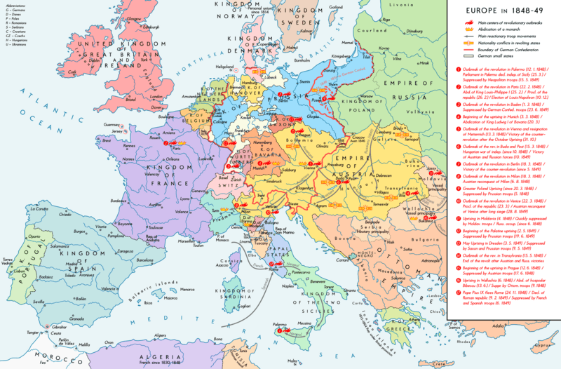
Image: Europe 1848 map en
Description: Europe 1848-49. Historical map with main revolutionary centres, important reactionary troop movements, states with abdications and national conflicts. Please don't alter the map, when you think there something not written or depicted correctly. Leave a message at the talk page of the file. After a verificiation and a possible discussion, i will upload a new map version with all new changes. This prevents an unnecessary waste of disc space and ensures a good result, aesthetically and contentwise. - The author.
Title: Europe 1848 map en
Credit: Own work. Source of Information: Historical atlases – Ramsay Muir, George Philip (ed.): Philip's New School Atlas of Universal History, George Philip & Son, Ltd., London 1928 – Dr. Walter Leisering (ed.): Putzger Historischer Weltatlas, Cornelsen Verlag, Berlin 1992, ISBN 3-464-00176-8 – Bayerischer Schulbuch-Verlag (ed.): Großer Historischer Weltatlas, Dritter Teil, Neuzeit, Bayerischer Schulbuch-Verlag, München 1981, ISBN 3-7627-6021-7 – Prof. Dr. Vadim Oswalt u. Prof. Dr. Hans Ulrich Rudolf (ed.): Klett-Perthes Atlas zur Weltgeschichte, Ernst Klett Verlag, Stuttgart 2011, ISBN 978-3-12-828194-0 – Zentralinstitut für Geschichte der Akademie der Wissenschaften der DDR (ed.): Atlas zur Geschichte, Band 1, VEB Hermann Haack, Gotha 1989, ISBN 3-7301-0040-8 – Domokos György (ed.): Történelmi atlasz a középiskolák számára, Kartográfiai Vállalat. Budapest, Budapest 1989, ISBN 963-351-422-3 Other publications – Mike Rapport: 1848. Revolution in Europa, Wissenschaftliche Buchgesellschaft, Lizenzausgabe des Konrad Theiss Verlags, 2011, ISBN 978-3-534-23963-4
Author: Alexander Altenhof
Usage Terms: Creative Commons Attribution-Share Alike 4.0
License: CC BY-SA 4.0
License Link: http://creativecommons.org/licenses/by-sa/4.0
Attribution Required?: Yes
Image usage
The following 4 pages link to this image:
