
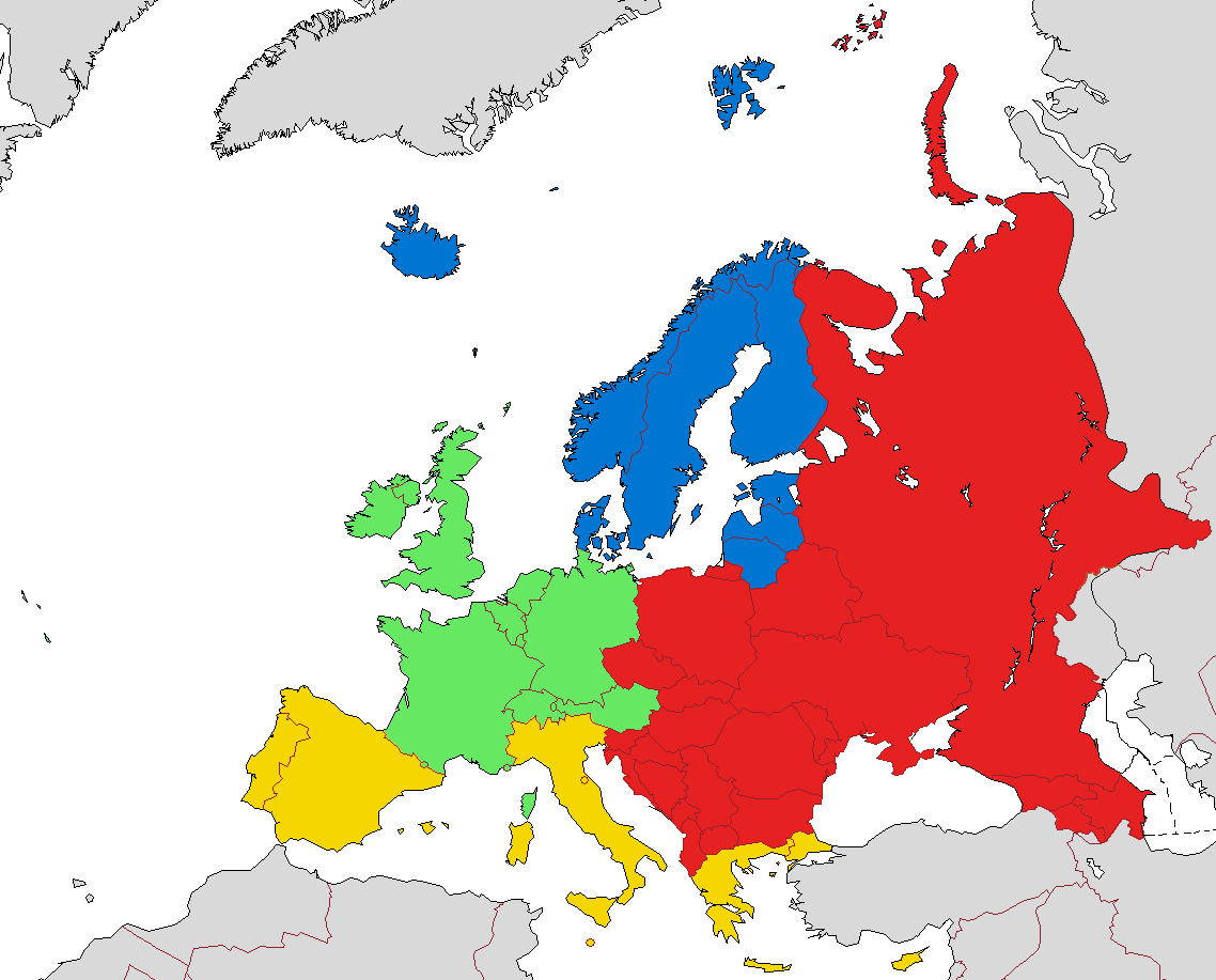
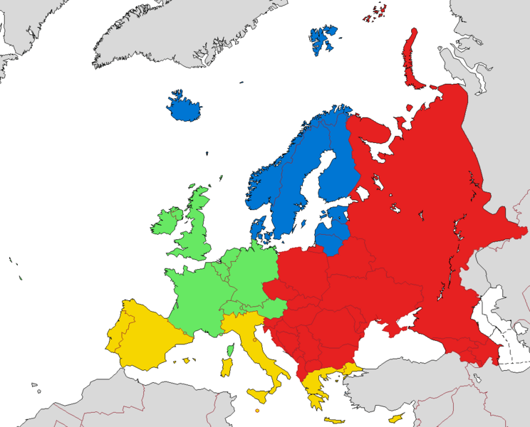
Image: European sub-regions (according to EuroVoc, the thesaurus of the EU)
Description: A map of European sub-regions and their boundaries, according to the categories set by EuroVoc (the European Union's official multilingual thesaurus). The regions in the image are colour-coded in the following manner: Blue - Northern Europe Green - Western Europe Red - Eastern Europe Yellow - Southern Europe Grey - Territories not considered part of Europe For reference: http://eurovoc.europa.eu/drupal/?q=request&uri=http://eurovoc.europa.eu/100277
Title: European sub-regions (according to EuroVoc, the thesaurus of the EU)
Credit: The map itself was created by me, based on this design: https://commons.wikimedia.org/wiki/File:Map_of_Europe_(political).png
Author: Samotny Wędrowiec
Usage Terms: Creative Commons Attribution-ShareAlike 3.0
License: CC-BY-SA-3.0
License Link: https://creativecommons.org/licenses/by-sa/3.0/
Attribution Required?: Yes
Image usage
The following page links to this image:

.png)