
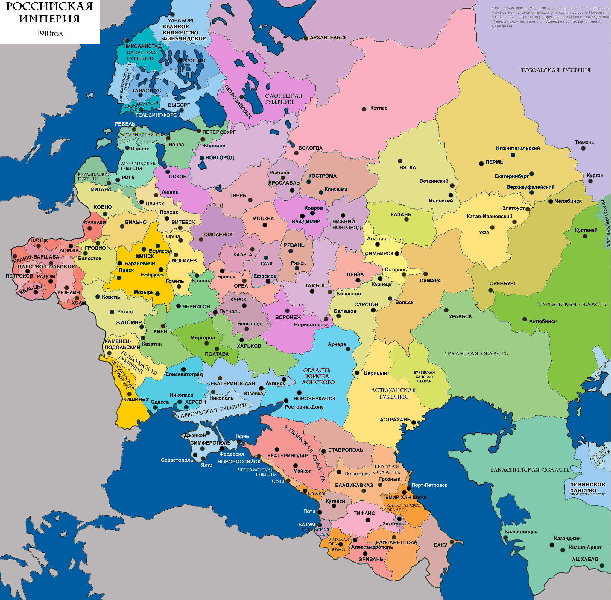
Image: Evropayskye gubernii Rossii 1910
Description: Gubernias of the European Russia 1910, according with H. Kehnert et H. Habenicht's map n° 43 Russland und Skandinavien, in the Stielers Hand-Atlas, Justus Perthes, Gotha, issue 1910, 440 pp., derivative work since Nikolay Sidorov's map Административное деление России (западная часть) в 1917, showing by colours the regions of Great-Russia, Little-Russia, New-Russia, Western-Russia, Eastern-Russia, Baltic Provinces, Gr-Duchy of Finland, Kingdpm of Poland, Caucasia, Central-Asia & Siberia.
Title: Evropayskye gubernii Rossii 1910
Credit: Own work
Author: Spiridon Ion Cepleanu
Usage Terms: Creative Commons Attribution-Share Alike 4.0
License: CC BY-SA 4.0
License Link: http://creativecommons.org/licenses/by-sa/4.0
Attribution Required?: Yes
Image usage
The following page links to this image:
