
Image: Excise Inland revenue map of Eastern Canada, 1884 CTASC
No higher resolution available.
Excise_Inland_revenue_map_of_Eastern_Canada,_1884_CTASC.jpg (600 × 275 pixels, file size: 222 KB, MIME type: image/jpeg)
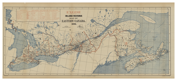
Description: Excise map of Great Lakes, St. Lawrence River, and Gulf of St. Lawrence regions. Counties are outlined. Cities, towns, canals, lakes and other bodies of water are named.
Title: Excise Inland revenue map of Eastern Canada, 1884
Credit: York University Libraries, Clara Thomas Archives & Special Collections, Historical map collection, HMC0005. http://digital.library.yorku.ca/islandora/object/yul:1153568
Author: Mortimer, A. Blatch, F. K.
Usage Terms: Public domain
License: Public domain
Attribution Required?: No
Image usage
The following page links to this image:

All content from Kiddle encyclopedia articles (including the article images and facts) can be freely used under Attribution-ShareAlike license, unless stated otherwise.