
Image: FEMA - 12091 - Photograph by FEMA ITS Mapping and Analysis taken on 11-04-2004 in District of Columbia
Size of this preview: 463 × 599 pixels. Other resolutions: 185 × 240 pixels | 1,275 × 1,650 pixels.
Original image (1,275 × 1,650 pixels, file size: 611 KB, MIME type: image/jpeg)
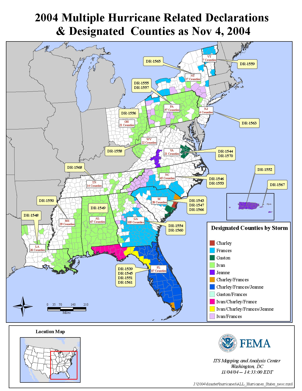
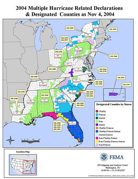
Description: Washington, DC, November 4, 2004 -- This is an illustration of the 2004 Multiple Hurricane Related Declarations and Designated counties as of Nov. 4, 2004. FEMA ITS Mapping and Analysis Center
Title: FEMA - 12091 - Photograph by FEMA ITS Mapping and Analysis taken on 11-04-2004 in District of Columbia
Credit: This image is from the FEMA Photo Library.
Author: FEMA ITS Mapping and Analysis
Usage Terms: Public domain
License: Public domain
Attribution Required?: No
Image usage
The following page links to this image:

All content from Kiddle encyclopedia articles (including the article images and facts) can be freely used under Attribution-ShareAlike license, unless stated otherwise.