
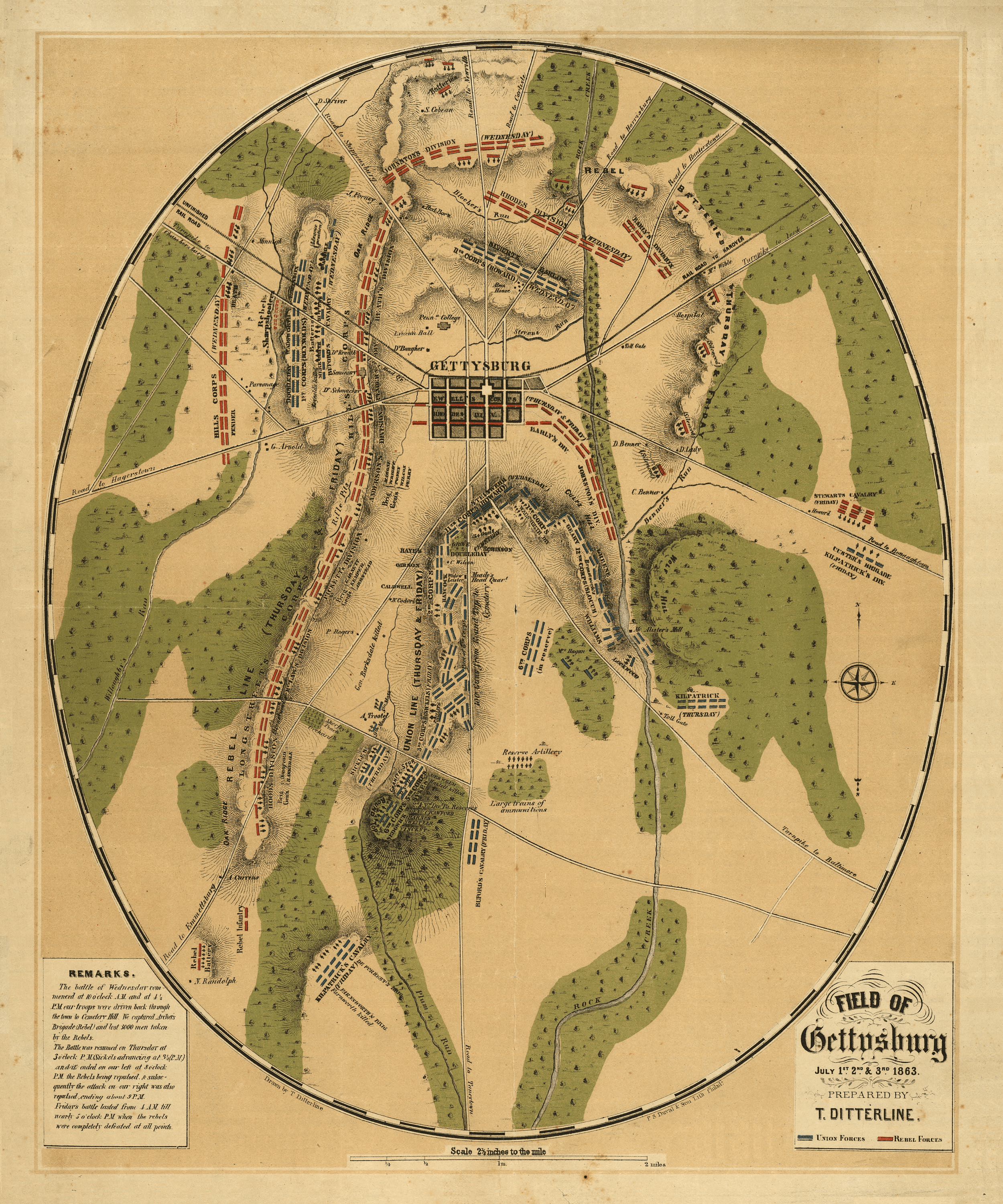
Image: FieldOfGettysburg1863
Description: This oval-shaped map depicts Gettysburg Battlefield during July 1st, 2nd & 3rd, 1863. Prepared by Theodore Ditterline and published by Philada. P. S. Duval & Son lith. in 1863, the map reveals the troop and artillery positions and movements, relief by hachures, drainage, roads, railroads, and houses with the names of residents at the time of the Battle of Gettysburg. This map was featured on the front page of the Library of Congress Civil War maps website on and around August 16, 2008. NOTES: Scale ca. 1:25,500,. Reference: LC Civil War Maps (2nd ed.), 331. From his Sketch of the battles of Gettysburg . . . New York, C. A. Alvord, 1863. 24 p.; Medium: 1 map col. 49 x 40 cm.; Call Number: G3824.G3S5 1863 .D42 CW 331; Repository: Library of Congress Geography and Map Division Washington, D.C. 20540-4650
Title: FieldOfGettysburg1863
Credit: Library of Congress Geography and Map Division, Washington, D.C. 20540-4650
Author: Theodore Ditterline
Permission: Public Domain
Usage Terms: Public domain
License: Public domain
Attribution Required?: No
Image usage
The following 2 pages link to this image:
