
Image: Final Dispersal Map
Size of this preview: 776 × 600 pixels. Other resolutions: 311 × 240 pixels | 1,056 × 816 pixels.
Original image (1,056 × 816 pixels, file size: 808 KB, MIME type: image/jpeg)
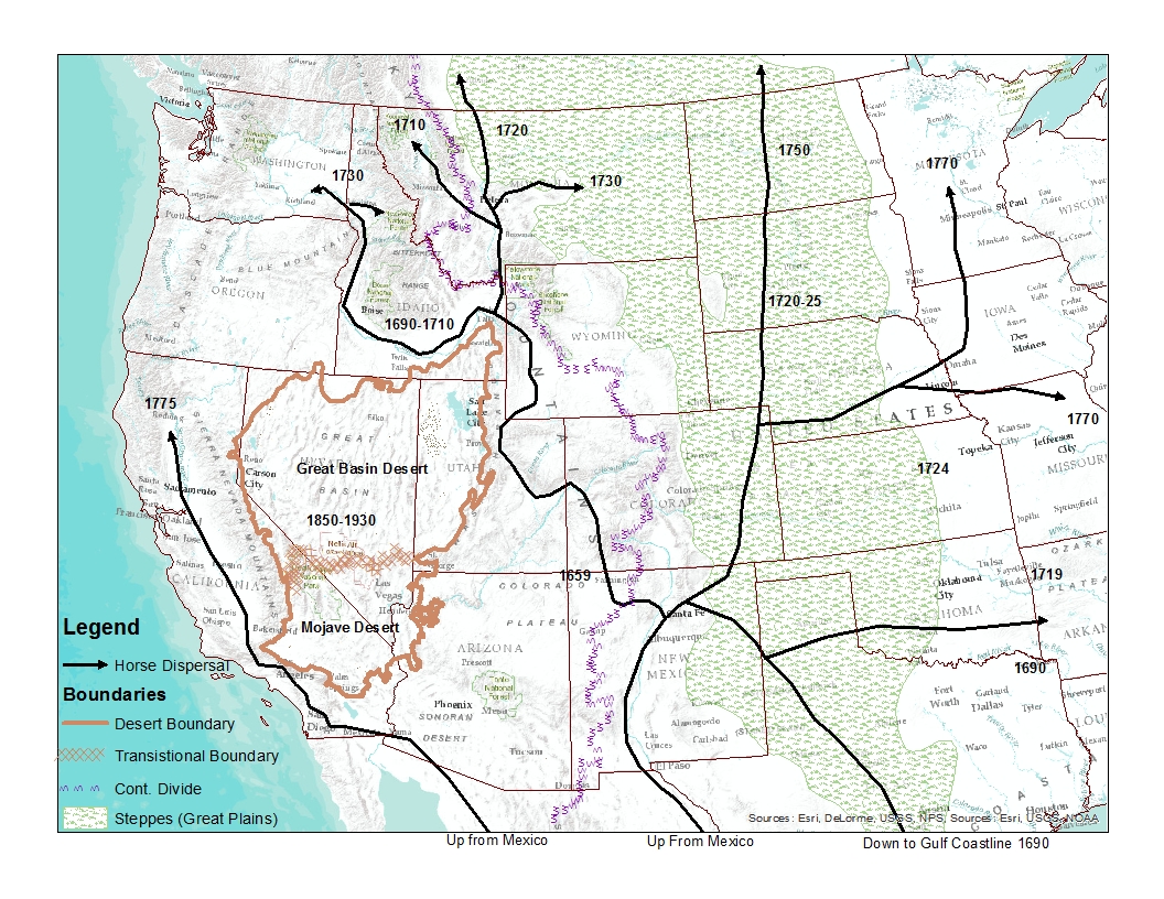
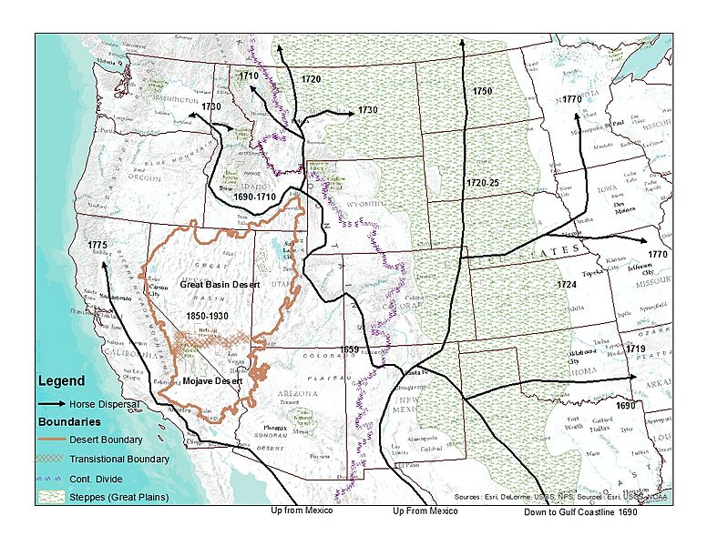
Description: Map with facsimile of horse dispersal from a map at: Haines, Francis. "The Northward Spread of Horses Among the Plains Indians." American Anthropologist New Series, Vol. 40, No. 3 (Jul. - Sep., 1938), pp. 429-437 at p. 430 online version. Depictions of the Great Basin and Continental Divide from USGS hydrographic .shp files. Depiction of the Great Plains from this map
Title: Final Dispersal Map
Credit: Own work
Author: LynnWysong
Usage Terms: Creative Commons Attribution-Share Alike 4.0
License: CC BY-SA 4.0
License Link: https://creativecommons.org/licenses/by-sa/4.0
Attribution Required?: Yes
Image usage
The following page links to this image:

All content from Kiddle encyclopedia articles (including the article images and facts) can be freely used under Attribution-ShareAlike license, unless stated otherwise.