
Image: First Punic War 264 BC v3

Size of this preview: 800 × 471 pixels. Other resolutions: 320 × 189 pixels | 1,412 × 832 pixels.
Original image (1,412 × 832 pixels, file size: 62 KB, MIME type: image/png)
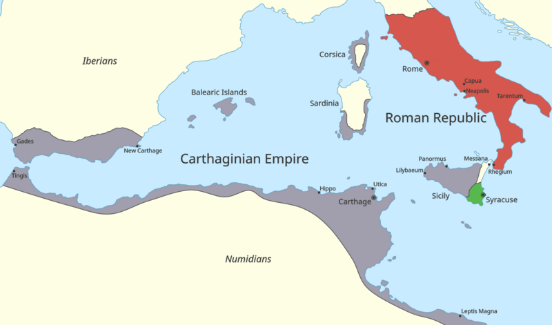
Description: Map of the western Mediterranean Sea in 264 BC, focusing on the states involved in the First Punic War.
Title: First Punic War 264 BC v3
Credit: This file was derived from: First Punic War 264 BC v2.png Changes: Adjusted Carthaginian territory in Corsica and Sardinia. Information from: Muir, Ramsay; Treharne R. F.; Fullard, Harold (1969). Muir's Historical Atlas. London: George Philip and Son. OCLC 1090019533 p. 11, map B.
Author: Harrias
Usage Terms: Creative Commons Attribution-Share Alike 4.0
License: CC BY-SA 4.0
License Link: https://creativecommons.org/licenses/by-sa/4.0
Attribution Required?: Yes
Image usage
The following page links to this image:

All content from Kiddle encyclopedia articles (including the article images and facts) can be freely used under Attribution-ShareAlike license, unless stated otherwise.