
Image: Fishingcreek susquehanna rivermap
Size of this preview: 596 × 600 pixels. Other resolutions: 239 × 240 pixels | 1,000 × 1,006 pixels.
Original image (1,000 × 1,006 pixels, file size: 527 KB, MIME type: image/png)
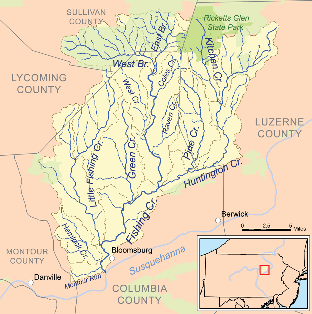
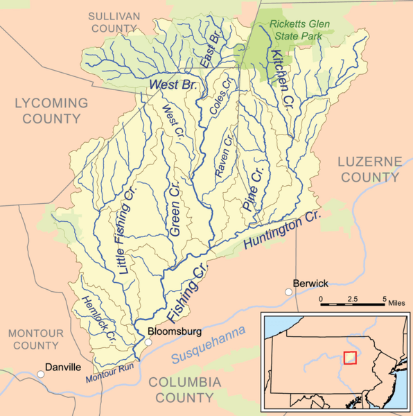
Description: This is a map of the drainage basin of Fishing Creek. The drainage basin is in yellow. State protected lands are in green (primarily Pennsylvania State Game Lands).
Title: Fishingcreek susquehanna rivermap
Credit: Own work, streams and basin boundaries are from the National Hydrography Dataset [1], state lands are from the Protected Areas Database [2], all other data are from the National Atlas [3].
Author: Kmusser
Usage Terms: Creative Commons Attribution-Share Alike 3.0
License: CC BY-SA 3.0
License Link: https://creativecommons.org/licenses/by-sa/3.0
Attribution Required?: Yes
Image usage
The following 2 pages link to this image:

All content from Kiddle encyclopedia articles (including the article images and facts) can be freely used under Attribution-ShareAlike license, unless stated otherwise.