
Image: FlandersRetreat

Size of this preview: 800 × 549 pixels. Other resolutions: 320 × 220 pixels | 2,841 × 1,949 pixels.
Original image (2,841 × 1,949 pixels, file size: 3.51 MB, MIME type: image/png)
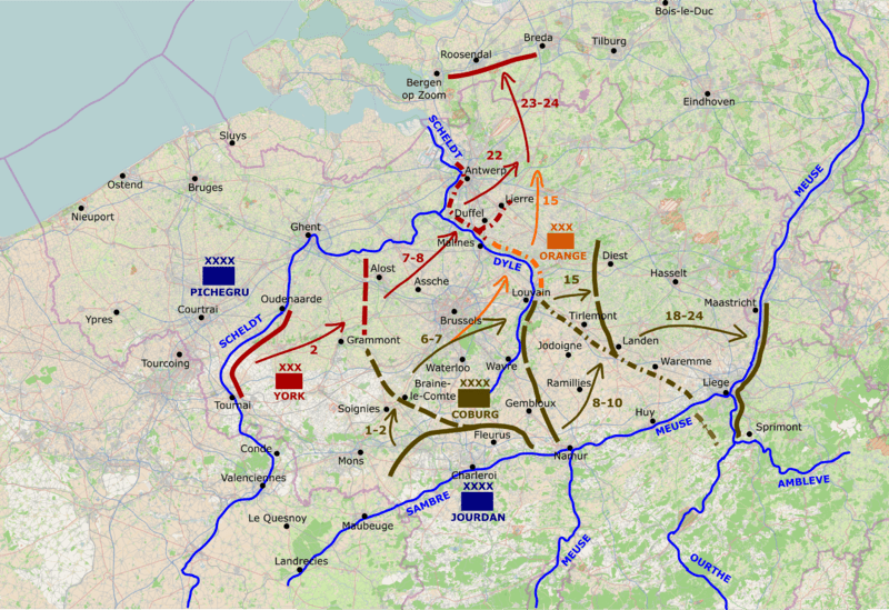
Description: Map showing the retreat of the Allied forces from Flanders in 1794 Background map © OpenStreetMap contributors Superimposed annotations and mapping © Talamioros
Title: FlandersRetreat
Credit: Own work based on: https://mc.bbbike.org/mc/?lon=4.418341&lat=50.438565&zoom=12&num=1&mt0=osm-no-labels&mt1=mapnik
Author: Talamioros
Usage Terms: Creative Commons Attribution-Share Alike 4.0
License: CC BY-SA 4.0
License Link: https://creativecommons.org/licenses/by-sa/4.0
Attribution Required?: Yes
Image usage
The following 2 pages link to this image:

All content from Kiddle encyclopedia articles (including the article images and facts) can be freely used under Attribution-ShareAlike license, unless stated otherwise.