
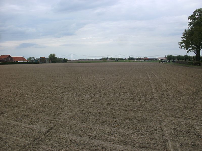
Image: Flanders fields at Langemark-Poelkapelle 1

Size of this preview: 800 × 600 pixels. Other resolutions: 320 × 240 pixels | 1,984 × 1,488 pixels.
Original image (1,984 × 1,488 pixels, file size: 877 KB, MIME type: image/jpeg)
Description: Fields at Langemark-Poelkapelle, Belgium: Photo taken from a position approx 50°55'13.4"N 2°54'54.6"E just west of Langemark German War Cemetery, facing approx north, towards the former location of the German trench from which the first gas attack was launched on 22 April 1915. In this area, the German trench system ran approximately from the farmhouse on the left to the group of willow trees visible on the right.
Title: Flanders fields at Langemark-Poelkapelle 1
Credit: Own work
Author: ViennaUK
Usage Terms: Creative Commons Attribution-Share Alike 4.0
License: CC BY-SA 4.0
License Link: http://creativecommons.org/licenses/by-sa/4.0
Attribution Required?: Yes
Image usage
The following page links to this image:

All content from Kiddle encyclopedia articles (including the article images and facts) can be freely used under Attribution-ShareAlike license, unless stated otherwise.