
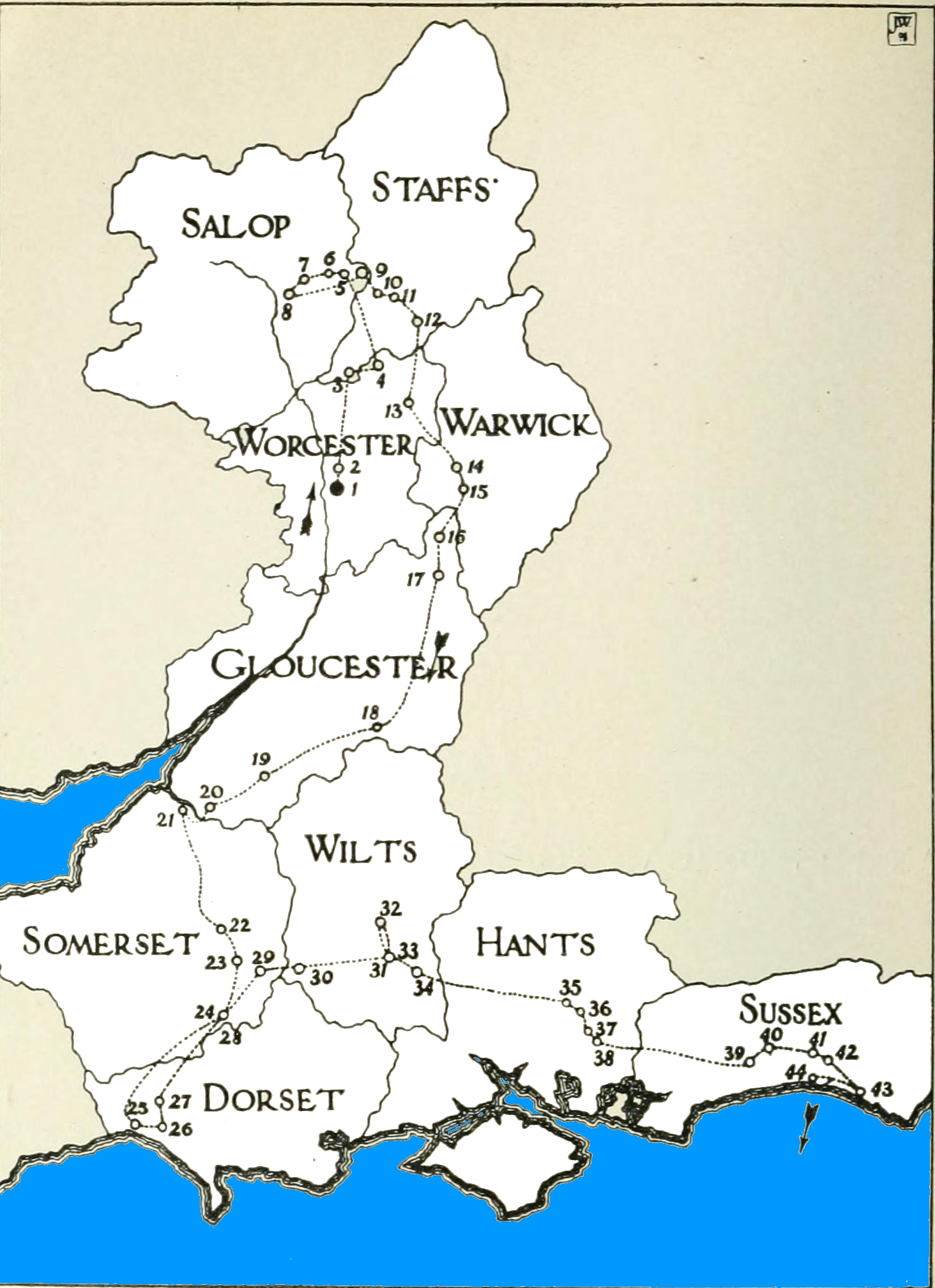
Image: Flight of the King, page 2
Size of this preview: 435 × 599 pixels. Other resolutions: 174 × 240 pixels | 1,464 × 2,016 pixels.
Original image (1,464 × 2,016 pixels, file size: 953 KB, MIME type: image/jpeg)
Description: Map of the route taken by King Charles II when he excaped from England to France (3 September – 16 October 1651)
Title: Flight of the King, page 2
Credit: Fea, Allan (1908) The flight of the king : a full, true, and particular account of the miraculous escape of His Most Sacred Majesty King Charles II after the battle of Worcester, London: Methuen, p. 2
Author: Allan Fea
Usage Terms: Public domain
License: Public domain
Attribution Required?: No
Image usage
The following page links to this image:

All content from Kiddle encyclopedia articles (including the article images and facts) can be freely used under Attribution-ShareAlike license, unless stated otherwise.