
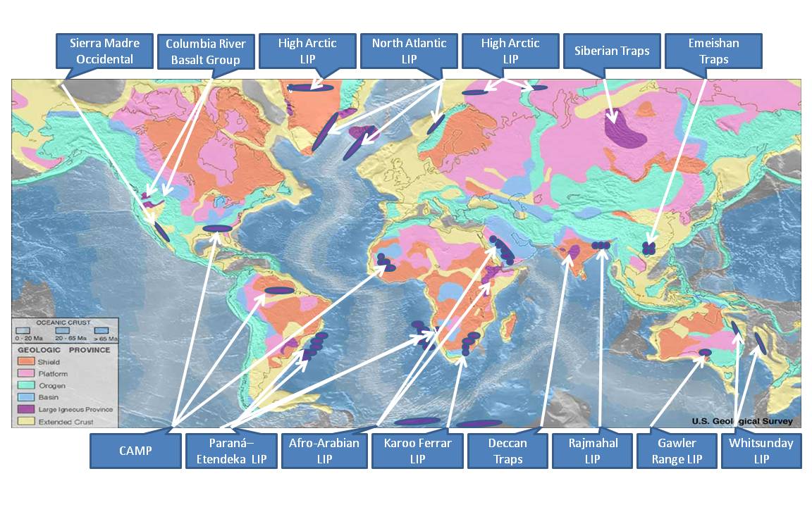
Image: Flood Basalt Map
Description: This file is an identification of large igneous provinces overlaid on a map produced by United States National Oceanic and Atmosphere Administration's National Geophysical Data Center. Intended for use in the Large igneous province page.
Title: Flood Basalt Map
Credit: Own work - based on markup of USGS map Source: http://earthquake.usgs.gov/research/structure/crust/maps.php ; original upload english wikipedia 22 April 2005 by SEWilco. The source figure is in the public domain because it contains materials that originally came from the United States Geological Survey, an agency of the United States Department of Interior. For more information, see the official USGS copyright policy.
Author: Williamborg
Usage Terms: Creative Commons Attribution-Share Alike 3.0
License: CC BY-SA 3.0
License Link: http://creativecommons.org/licenses/by-sa/3.0
Attribution Required?: Yes
Image usage
The following page links to this image:
