
Image: Flooding in the Ipswich suburb of Gailes
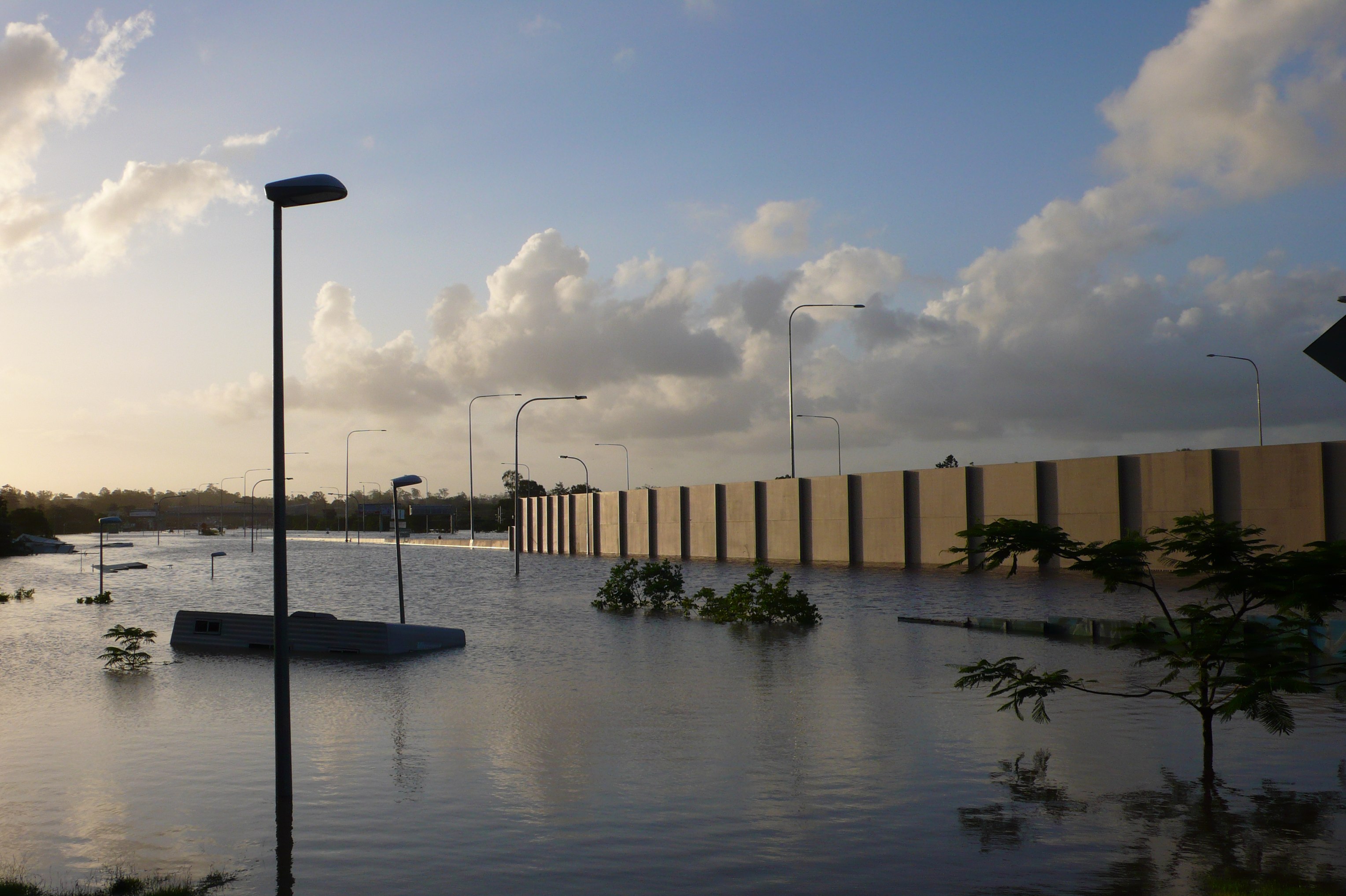
Description: Flooding in the Ipswich suburb of Gailes - Ipswich Motorway is behind the beige panels, followed by an integral motorway bridge (above the caravan roof, framed by the two foreground light posts) over Woogaroo stream - approx. 10m below. In front of the motorway is Brisbane Rd, a service road following the curve of the motorway, declining then leveling - approx. 5m below motorway level - around the end of the panels. In the foreground, and left, is part of a caravan park which continues down to the stream - top of service road fence is just showing out of water at right.
Title: Flooding in the Ipswich suburb of Gailes
Credit: Flickr: Brisbane Floods - Gailes Queensland
Author: Martin Howard
Permission: This image, which was originally posted to Flickr, was uploaded to Commons using Flickr upload bot on 12 January 2011, 14:19 by Bidgee. On that date, it was confirmed to be licensed under the terms of the license indicated. This file is licensed under the Creative Commons Attribution 2.0 Generic license. You are free: to share – to copy, distribute and transmit the work to remix – to adapt the work Under the following conditions: attribution – You must give appropriate credit, provide a link to the license, and indicate if changes were made. You may do so in any reasonable manner, but not in any way that suggests the licensor endorses you or your use. https://creativecommons.org/licenses/by/2.0 CC BY 2.0 Creative Commons Attribution 2.0 truetrue
Usage Terms: Creative Commons Attribution 2.0
License: CC BY 2.0
License Link: https://creativecommons.org/licenses/by/2.0
Attribution Required?: Yes
Image usage
The following page links to this image:
