
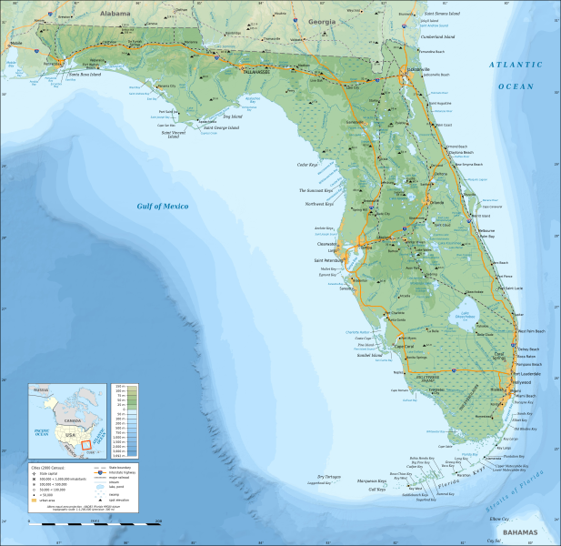
Image: Florida topographic map-en

Description: Topographic map of the State of Florida, USA (2000 Census). Note: the background map is a raster image embedded in the SVG file.
Title: Florida topographic map-en
Credit: Own work Sources of data: Topography and bathymetry: NGDC Coastal Relief Model completed with ETOPO1 (public domain); GSHHS (public domain); Public domain data provided by the National Atlas of the United States of America and VMap-0; Icons of the Interstate highways: File:I-4.svg, File:I-10.svg, File:I-65.svg, File:I-75.svg and File:I-95.svg released in public domain by Ltljltlj;
Author: Eric Gaba (Sting - fr:Sting)
Permission: Attribution and Share-Alike required Any use of this map can be made as long as you credit me (Eric Gaba – Wikimedia Commons user: Sting) as the author and distribute the copies and derivative works under the same license(s) that the one(s) stated below. A message with a reply address would also be greatly appreciated.
Usage Terms: GNU Free Documentation License
License: GFDL
License Link: http://www.gnu.org/copyleft/fdl.html
Attribution Required?: Yes
Image usage
The following 2 pages link to this image:
