
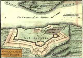
Image: FortDaupinCapeBreton (inset) A new and accurate map of the English empire in North America, 1755

Size of this preview: 800 × 558 pixels. Other resolutions: 320 × 223 pixels | 901 × 629 pixels.
Original image (901 × 629 pixels, file size: 1.02 MB, MIME type: image/png)
Description: A new and accurate map of the English empire in North America; Representing their rightful claim as confirmed by charters and the formal surrender of their Indian friends; likewise the encroachments of the French, with the several forts they have unjustly erected therein.
Title: FortDaupinCapeBreton (inset) A new and accurate map of the English empire in North America, 1755
Credit: http://memory.loc.gov/cgi-bin/query/h?ammem/gmd:@field(NUMBER+@band(g3300+ar006200))
Author: London, Sold by Wm. Herbert ... , 1755.
Usage Terms: Public domain
License: Public domain
Attribution Required?: No
Image usage
The following 2 pages link to this image:

All content from Kiddle encyclopedia articles (including the article images and facts) can be freely used under Attribution-ShareAlike license, unless stated otherwise.
_A_new_and_accurate_map_of_the_English_empire_in_North_America,_1755.png)