
Image: Fort Henry to Fort Donelson
Size of this preview: 800 × 403 pixels. Other resolutions: 320 × 161 pixels | 2,549 × 1,284 pixels.
Original image (2,549 × 1,284 pixels, file size: 515 KB, MIME type: image/png)
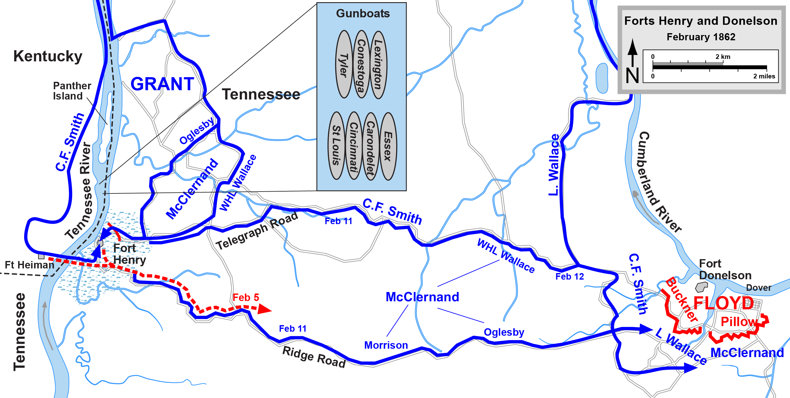
Description: This map shows the approach of the union troops to Fort Donelson beginning with the attack of Fort Henry
Title: Fort Henry to Fort Donelson
Credit: Transferred from en.wikipedia to Commons.; Graphic source file is available at http://www.posix.com/CWmaps/Fort_Henry_to_Fort_Donelson.png
Author: Drawn in Adobe Illustrator CS5 by Hal Jespersen (Hlj at English Wikipedia)
Permission: Declaration of Hal Jespersen
Usage Terms: Creative Commons Attribution 3.0
License: CC BY 3.0
License Link: http://creativecommons.org/licenses/by/3.0
Attribution Required?: Yes
Image usage
The following 3 pages link to this image:

All content from Kiddle encyclopedia articles (including the article images and facts) can be freely used under Attribution-ShareAlike license, unless stated otherwise.