
Image: Fortifications after Raid on Lorient 1746 map-fr

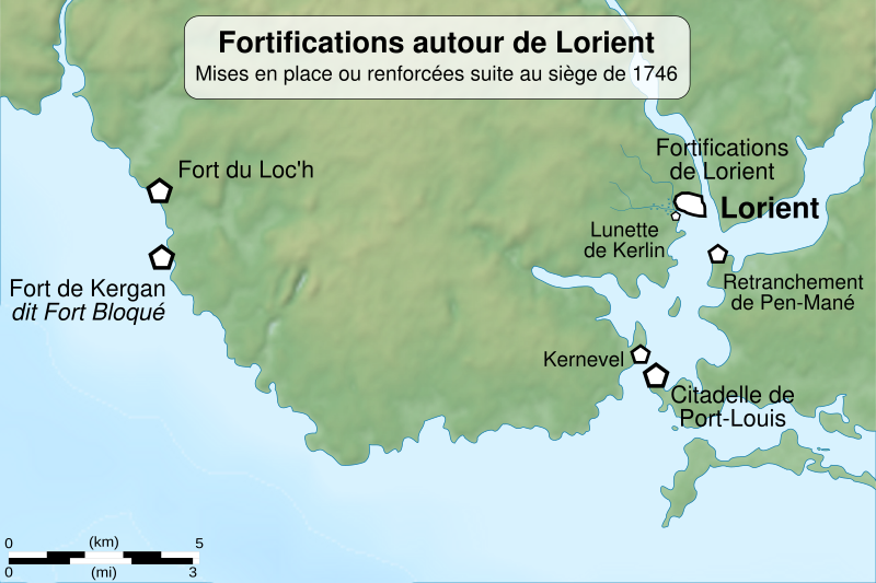
Description: Map of the fortifications built after the british raid on Lorient in october 1746. Lorient is a town in Brittany, France.
Title: Fortifications after Raid on Lorient 1746 map-fr
Credit: Sources: Background : File:Lorient arrondissement relief location map.svg by Sémhur (CC-BY-SA-3.0) Shoreline in the south of Lorient : File:Les environs de l'Orient et du Port-Louis par Georges-Louis Le Rouge.jpeg by Georges-Louis Le Rouge, uploaded in Commons by XIIIfromTOKYO under public domain licence. Fortification locations : Les principales fortifications autour de Lorient in Guillaume Lécuillier, « Quand l’ennemi venait de la mer », Annales de Bretagne et des Pays de l’Ouest [En ligne], 114-4
Author: Sémhur (talk)
Usage Terms: Creative Commons Attribution-Share Alike 4.0
License: CC BY-SA 4.0
License Link: https://creativecommons.org/licenses/by-sa/4.0
Attribution Required?: Yes
Image usage
The following page links to this image:
