
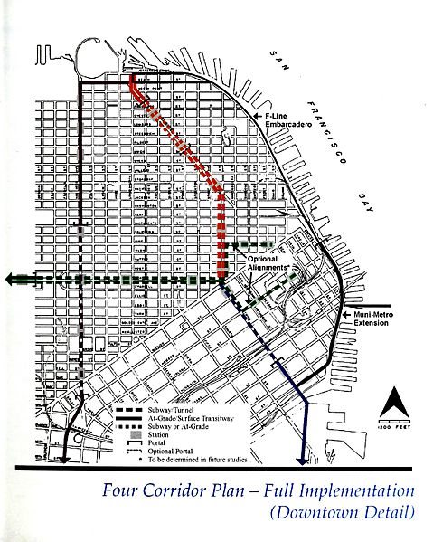
Image: Four Corridor Plan -- Full Implementation (Downtown Detail)

Description: Full implementation of the Four Corridor Plan of 1995. The eponymous corridors are: Bayshore (Blue, south from Geary and Market via Third) Geary (Green, continuing west off the map from Geary and Market) North Beach (Orange, continuing north from Geary and Market to Aquatic Park via Kearny and Columbus) Van Ness (Purple, on the western edge of this map from Aquatic Park to 16th & Mission via Van Ness)
Title: Four Corridor Plan -- Full Implementation (Downtown Detail)
Credit: https://archive.org/details/fourcorridorplan95sanf/page/n7/mode/2up
Author: Unknown / uncredited artist(s) for the San Francisco County Transportation Authority
Usage Terms: Public domain
License: Public domain
Attribution Required?: No
Image usage
The following page links to this image:

.jpg)