
Image: France L-2 (1812)-fr

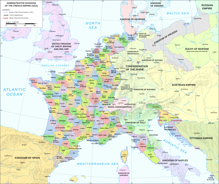
Description: Administrative divisions of the First French Empire in 1812
Title: Map administrative divisions of the First French Empire 1812-en
Credit: Map of Europe in 1811 (French Empire), Cambridge Modern History Atlas, 1912: https://commons.wikimedia.org/wiki/File:1french-empire1811.jpg Rheinbund 1812, political map, created by ziegelbrenner CC-BY-SA 3.0: https://commons.wikimedia.org/wiki/File:Rheinbund_1812,_political_map.png France location map-Departements 1812, created by Flappiefh CC-BY-SA 4.0: https://commons.wikimedia.org/wiki/File:France_location_map-Departements_1812.svg Geographic background (rivers, water bodies) - derived from Natural Earth datasets: http://www.naturalearthdata.com/downloads/10m-physical-vectors/ The shaded relief is an embedded raster graphic and is derived from the shaded relief created by Kenneth Townsend: http://www.shadedreliefarchive.com/Europe_townsend.html
Author: Andrein
Usage Terms: Creative Commons Attribution-Share Alike 4.0
License: CC BY-SA 4.0
License Link: https://creativecommons.org/licenses/by-sa/4.0
Attribution Required?: Yes
Image usage
The following image is a duplicate of this image (more details):
The following page links to this image:

-fr.svg)