
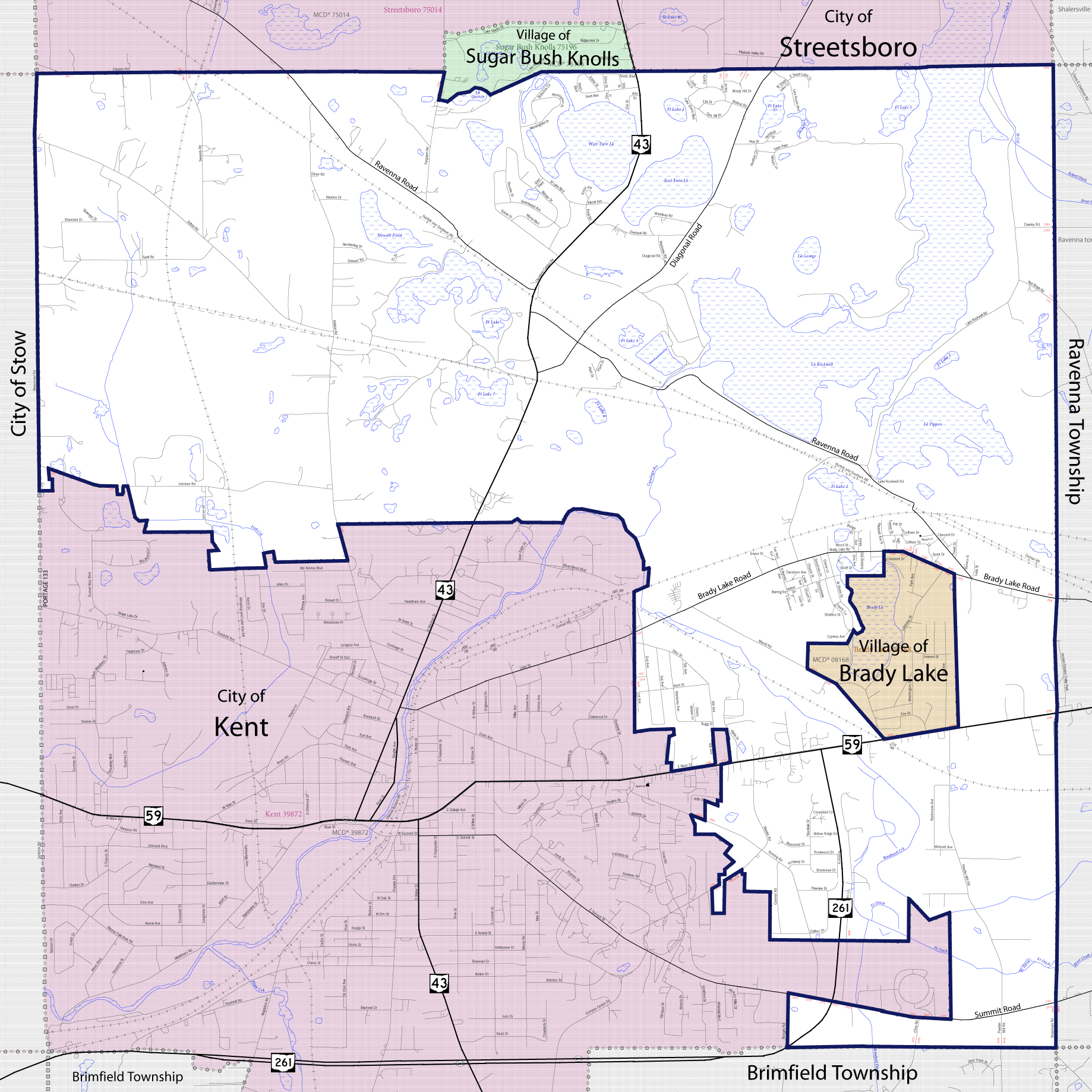
Image: Franklin Township map
Description: Map of Franklin Township in Portage County, Ohio, showing boundaries and roads with main roads highlighted. Base map from the U.S. Census Bureau's 2009 Boundary and Annexation Survey
Title: Franklin Township map
Credit: http://ftp2.census.gov/geo/pvs/bas/bas09/st39_oh/mcd/m3928392_franklin/BAS09M33913328392_001.pdf
Author: U.S. Census Bureau, Jon Ridinger
Permission: I, the copyright holder of this work, hereby publish it under the following licenses: This image or file is a work of a United States Census Bureau employee, taken or made as part of that person's official duties. As a work of the U.S. federal government, the image is in the public domain. English | Español | മലയാളം | Русский | Українська | +/− This file is licensed under the Creative Commons Attribution 3.0 Unported license. You are free: to share – to copy, distribute and transmit the work to remix – to adapt the work Under the following conditions: attribution – You must attribute the work in the manner specified by the author or licensor (but not in any way that suggests that they endorse you or your use of the work). http://creativecommons.org/licenses/by/3.0 CC BY 3.0 Creative Commons Attribution 3.0 truetrue You may select the license of your choice.
Usage Terms: Public domain
License: Public domain
Attribution Required?: No
Image usage
The following page links to this image:
