
Image: Fula jihad states map general c1830
No higher resolution available.
Fula_jihad_states_map_general_c1830.png (694 × 408 pixels, file size: 94 KB, MIME type: image/png)
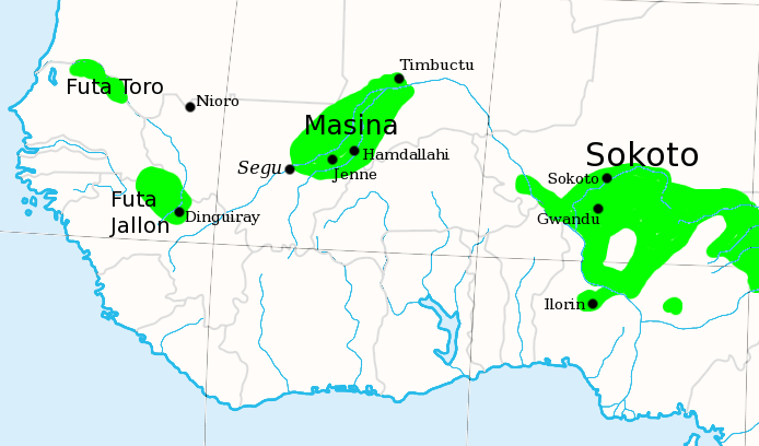
Description: I made this, using the commons' en:Image:Africa_map_blank.svg as a template. Shows the major Fula / Fulani /Peul Jihad states of West Africa, circa 1830, prior to the rise of Umar Tall.
Title: Fula jihad states map general c1830
Credit: Transfered from en.wikipedia
Author: Original uploader was T L Miles at en.wikipedia
Permission: Released into the public domain (by the author).
Usage Terms: Public domain
License: Public domain
Attribution Required?: No
Image usage
The following 4 pages link to this image:

All content from Kiddle encyclopedia articles (including the article images and facts) can be freely used under Attribution-ShareAlike license, unless stated otherwise.