
Image: Funj Sultanate 1700
Size of this preview: 695 × 599 pixels. Other resolutions: 278 × 240 pixels | 900 × 776 pixels.
Original image (900 × 776 pixels, file size: 70 KB, MIME type: image/png)
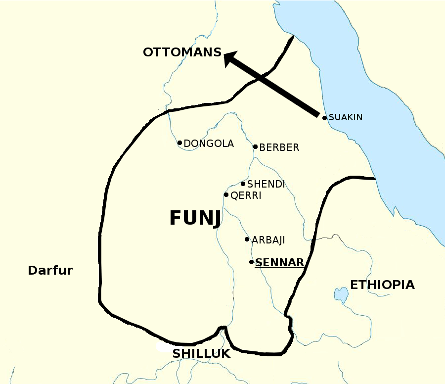
Description: Map of the Funj Sultanate in 1700 AD. Based on Jay Spaulding (1985): "The Heroic Age in Sennar" and modified via Stephanie Beswick (2014): "The Role of Slavery in the Rise and Fall of the Shilluk Kingdom", who claims that the Funj only controlled the northern half of the Shilluk kingdom, not the entirety of it. I admit, this map is no beauty, but in the moment I have no time to enhance it further.
Title: Funj Sultanate 1700
Credit: Own work
Author: LeGabrie
Usage Terms: Creative Commons Attribution-Share Alike 4.0
License: CC BY-SA 4.0
License Link: https://creativecommons.org/licenses/by-sa/4.0
Attribution Required?: Yes
Image usage
The following page links to this image:

All content from Kiddle encyclopedia articles (including the article images and facts) can be freely used under Attribution-ShareAlike license, unless stated otherwise.