
Image: Gambia satellite fires
Size of this preview: 800 × 242 pixels. Other resolutions: 320 × 97 pixels | 1,432 × 433 pixels.
Original image (1,432 × 433 pixels, file size: 103 KB, MIME type: image/jpeg)
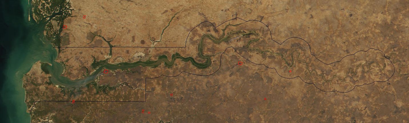
Description: Image cropped to The Gambia. The red dots sprinkled all across this true-color image show the locations of fires mostly located in the African savannas just south of the Sahel region. Many fires were burning in this region throughout February 2002. This scene was acquired by the Moderate-resolution Imaging Spectroradiometer (MODIS), flying aboard NASA's Terra satellite, on Feb. 15.
Title: Gambia satellite fires
Credit: Cropped from: http://visibleearth.nasa.gov/view_rec.php?id=2521
Author: Jacques Descloitres, MODIS Land Rapid Response Team at NASA GSFC
Usage Terms: Public domain
License: Public domain
Attribution Required?: No
Image usage
The following page links to this image:

All content from Kiddle encyclopedia articles (including the article images and facts) can be freely used under Attribution-ShareAlike license, unless stated otherwise.