
Image: GeneralGovernment1940Map
Size of this preview: 561 × 599 pixels. Other resolutions: 225 × 240 pixels | 2,594 × 2,770 pixels.
Original image (2,594 × 2,770 pixels, file size: 899 KB, MIME type: image/png)
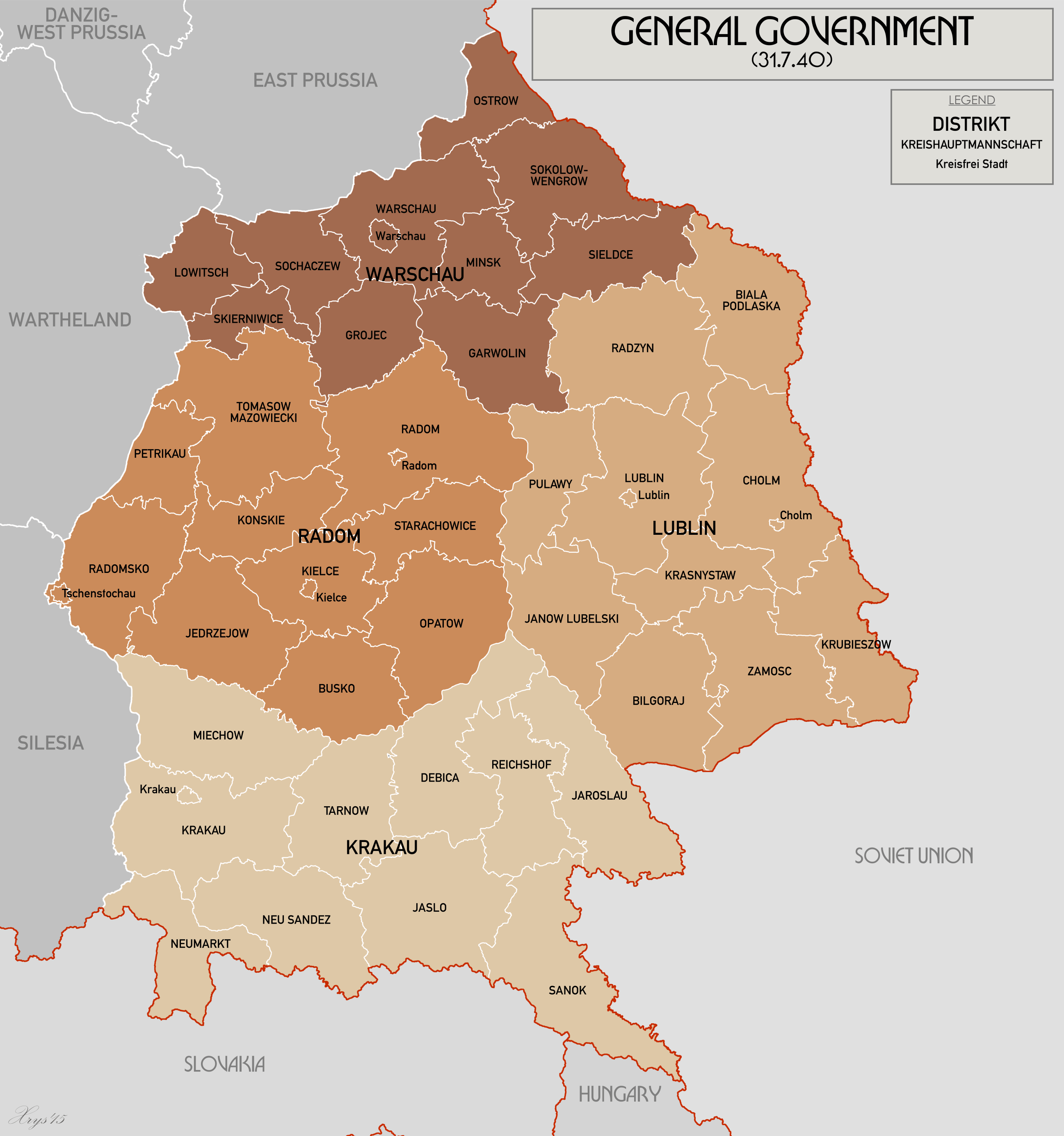
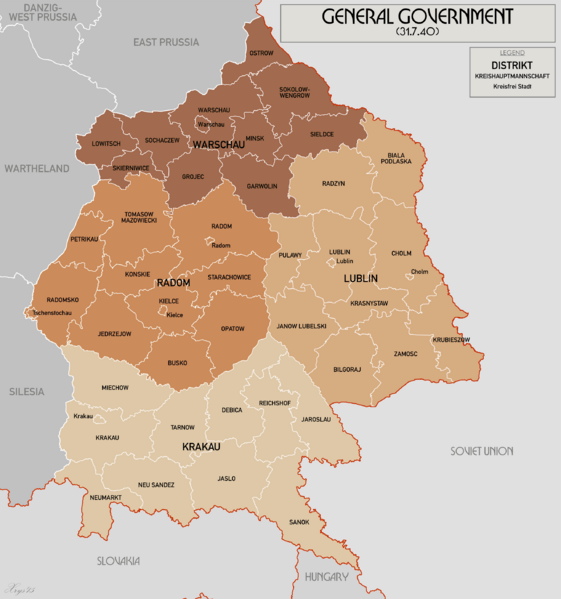
Description: Administrative Map of the General Government in 1940, before the invasion of the Soviet Union. Map data from Karte des Deutschen Reiches 100k, Mapa Administracyjna Rzeczypospolitej Polska 300k (courtesy of mapyWIG).
Title: GeneralGovernment1940Map
Credit: Own work
Author: XrysD
Usage Terms: Creative Commons Attribution-Share Alike 4.0
License: CC BY-SA 4.0
License Link: https://creativecommons.org/licenses/by-sa/4.0
Attribution Required?: Yes
Image usage
The following page links to this image:

All content from Kiddle encyclopedia articles (including the article images and facts) can be freely used under Attribution-ShareAlike license, unless stated otherwise.