
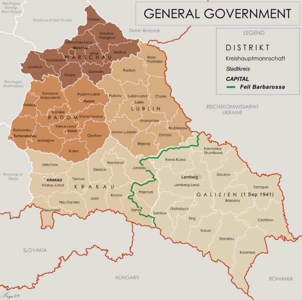
Image: General Government for the occupied Polish territories (1941)

Description: Map of the administrative areas of the General Government
Title: General Government for the occupied Polish territories (1941)
Credit: Own work by XrysD, edited by Poeticbent with superimposed German-Soviet border before Operation Barbarossa. Sources at: File:Generalne gubernatorstwo 1945.png and File:Western portions of the Ukrainian SSR 1940.jpg A published source with the same information is Musial, Bogdan (2000) (in German) Deutsche Zivilverwaltung und Judenverfolgung im Generalgouvernement: eine Fallstudie zum Distrikt Lublin 1939-1944, Otto Harrassowitz Verlag, p. 424 ISBN: 978-3-447-05063-0.
Author: XrysD and User:Poeticbent (the 1941 demarkation line and legend)
Usage Terms: Creative Commons Attribution-Share Alike 3.0
License: CC BY-SA 3.0
License Link: https://creativecommons.org/licenses/by-sa/3.0
Attribution Required?: Yes
Image usage
The following page links to this image:

.png)