
Image: Geological Map NW England Garwood 1912 03

Size of this preview: 650 × 599 pixels. Other resolutions: 260 × 240 pixels | 8,929 × 8,234 pixels.
Original image (8,929 × 8,234 pixels, file size: 8.04 MB, MIME type: image/jpeg)
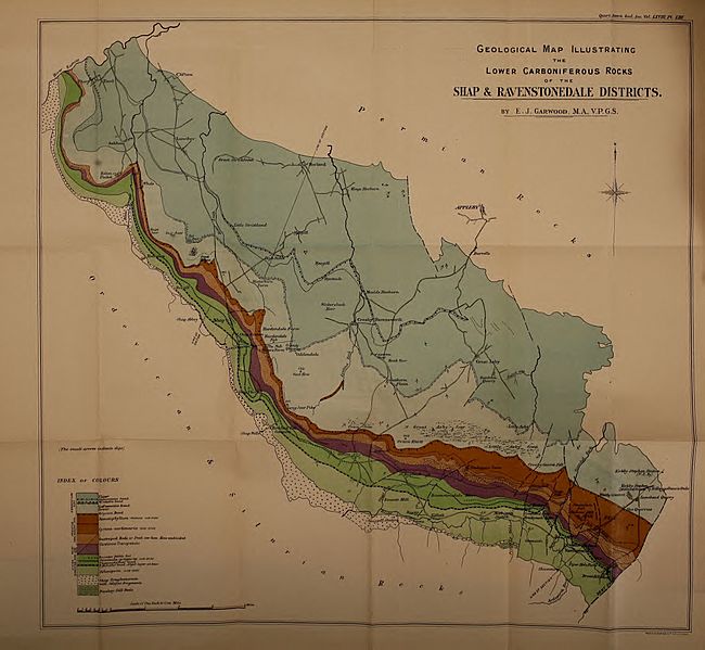
Description: Geological map illustrating the lower carboniferous rocks of the Shap and Ravenstonedale districts. Plate LII from Garwood, E.J. (1912). "The Lower Carboniferous Succession in the North-West of England". The Quarterly journal of the Geological Society of London 68: 449-586.
Title: Geological Map NW England Garwood 1912 03
Credit: https://archive.org/details/garwood-1913-quarterlyjournal-81912geol
Author: Edmund Johnston Garwood
Usage Terms: Public domain
License: Public domain
Attribution Required?: No
Image usage
The following page links to this image:

All content from Kiddle encyclopedia articles (including the article images and facts) can be freely used under Attribution-ShareAlike license, unless stated otherwise.