
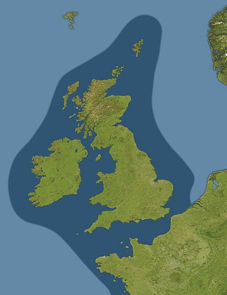
Image: German Submarine Zone February 1915 after Reynolds et al

Size of this preview: 462 × 599 pixels. Other resolutions: 185 × 240 pixels | 1,273 × 1,651 pixels.
Original image (1,273 × 1,651 pixels, file size: 286 KB, MIME type: image/jpeg)
Description: Map showing submarine warfare zone around the United Kingdom, declared by Germany on February 18 1915.
Title: German Submarine Zone February 1915 after Reynolds et al
Credit: German_Submarine_Zone_February_1915_SGW_Vol_V.png Europe_satellite_image_location_map.jpg
Author: German_Submarine_Zone_February_1915_SGW_Vol_V.png: artist not identified Europe_satellite_image_location_map.jpg: NordNordWest derivative work: Bellhalla (talk)
Usage Terms: Public domain
License: Public domain
Attribution Required?: No
Image usage
The following 2 pages link to this image:

All content from Kiddle encyclopedia articles (including the article images and facts) can be freely used under Attribution-ShareAlike license, unless stated otherwise.