
Image: Gettysburg Topographical Map

Size of this preview: 463 × 599 pixels. Other resolutions: 185 × 240 pixels | 1,502 × 1,943 pixels.
Original image (1,502 × 1,943 pixels, file size: 883 KB, MIME type: image/jpeg)
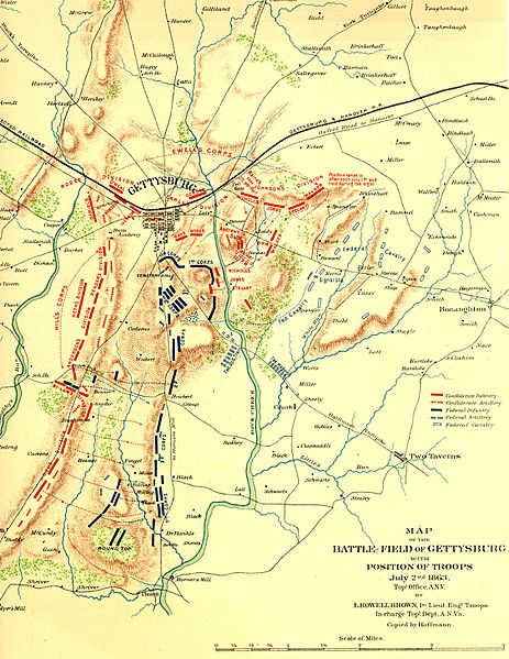
Description: Topografische stafkaart van de Slag bij Gettysburg Opgesteld door de topografische dienst van het Army of Northern Virginia Juli, 1863 Publiek domein -- auteursrecht op deze kaart heeft nooit bestaan
Title: Gettysburg Topographical Map
Usage Terms: Public domain
License: Public domain
Attribution Required?: No
Image usage
The following page links to this image:

All content from Kiddle encyclopedia articles (including the article images and facts) can be freely used under Attribution-ShareAlike license, unless stated otherwise.