
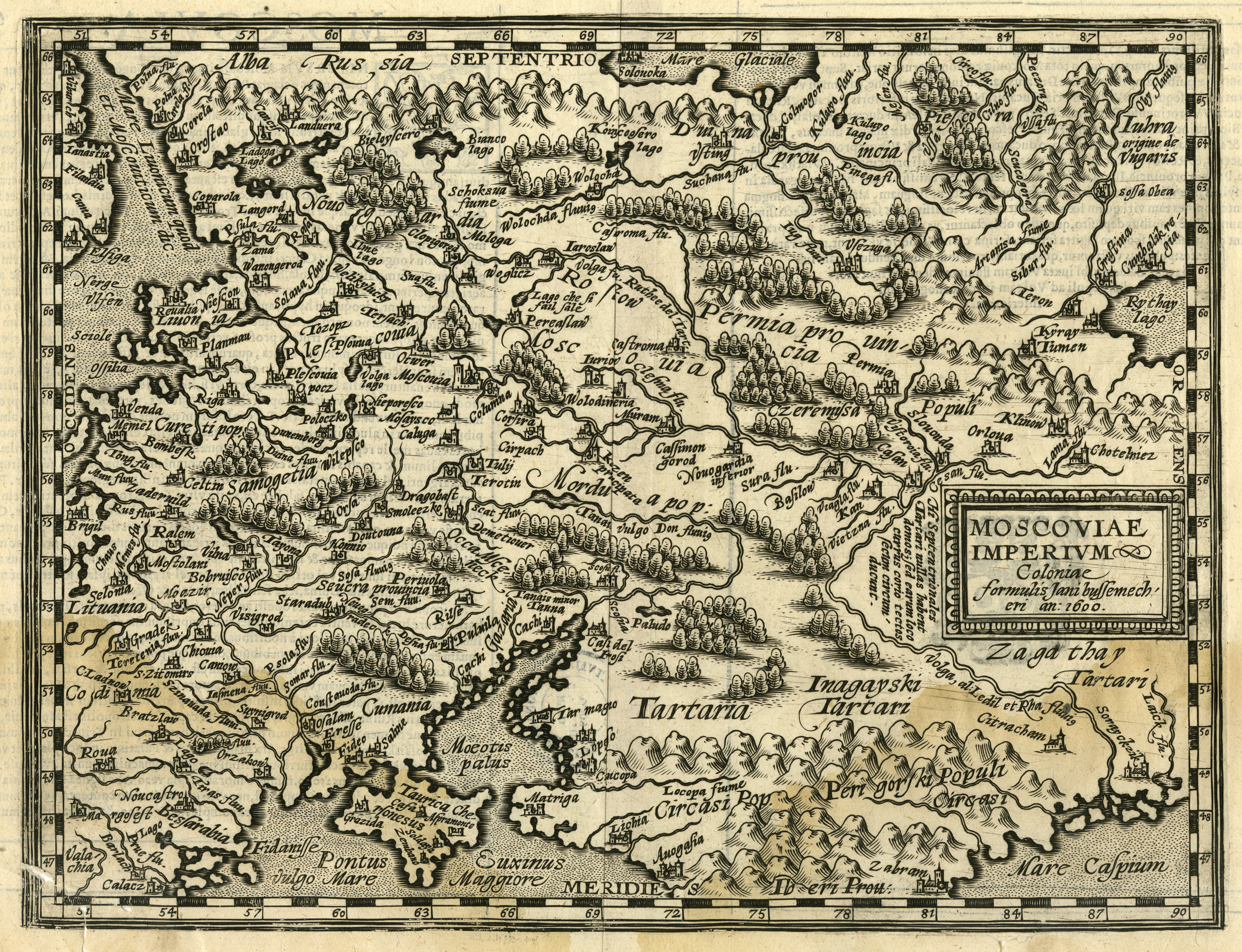
Image: Giovanni Antonio Magini. Moscoviae Imperivm. 1608
Description: The map of Muscovite Empire includes also the territory of old Livonia and the North-eastern part of the Baltic Sea. The map depicts the end of the 16th century – the beginning of the 17th century cartographers’ notion of the Baltic Sea coastlines geographic view, which is of interest to us. Even though in the territory of present-day Latvia only a few place-names are noted (Riga, Venda, Dunemborg, Duina fluu., and Cureti pop.) and the coastline is significantly misrepresented, the map is testimony to the increasing geographical knowledge in Europe about our land. The map is included in M. Quad’s atlas published in Cologne in 1608. This map is a copy of G. A. Magini’s map of Moscowy, which was first published in the 1596 edition of Claudius Ptolemy’s Geography.
Title: Giovanni Antonio Magini. Moscoviae Imperivm. 1608
Credit: www.theeuropeanlibrary.org
Author: Giovanni Antonio Magini
Usage Terms: Public domain
License: Public domain
Attribution Required?: No
Image usage
The following page links to this image:
