
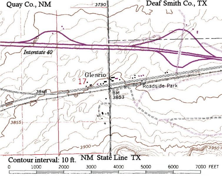
Image: Glenrio-topographic-map

Size of this preview: 755 × 600 pixels. Other resolutions: 302 × 240 pixels | 1,013 × 805 pixels.
Original image (1,013 × 805 pixels, file size: 732 KB, MIME type: image/png)
Description: Topographic map of Glenrio, (New Mexico, Texas) showing about a mile N-S and 1.5 miles E-W, including Interstate 40. The state and county designations have been added to the USGS base, as well as labeling Interstate 40.
Title: Glenrio-topographic-map
Credit: USGS 1:24000 quddrangle, Glenrio, N. Mex. - Tex., N3507.5-W10300/7.5 (1968, photorevised 1982) DMA 5354 II NE - Series V881
Author: United States Geological Survey (USGS), modified by Bejnar
Permission: public domain
Usage Terms: Public domain
License: Public domain
Attribution Required?: No
Image usage
The following page links to this image:

All content from Kiddle encyclopedia articles (including the article images and facts) can be freely used under Attribution-ShareAlike license, unless stated otherwise.