
Image: Godavari satellite view
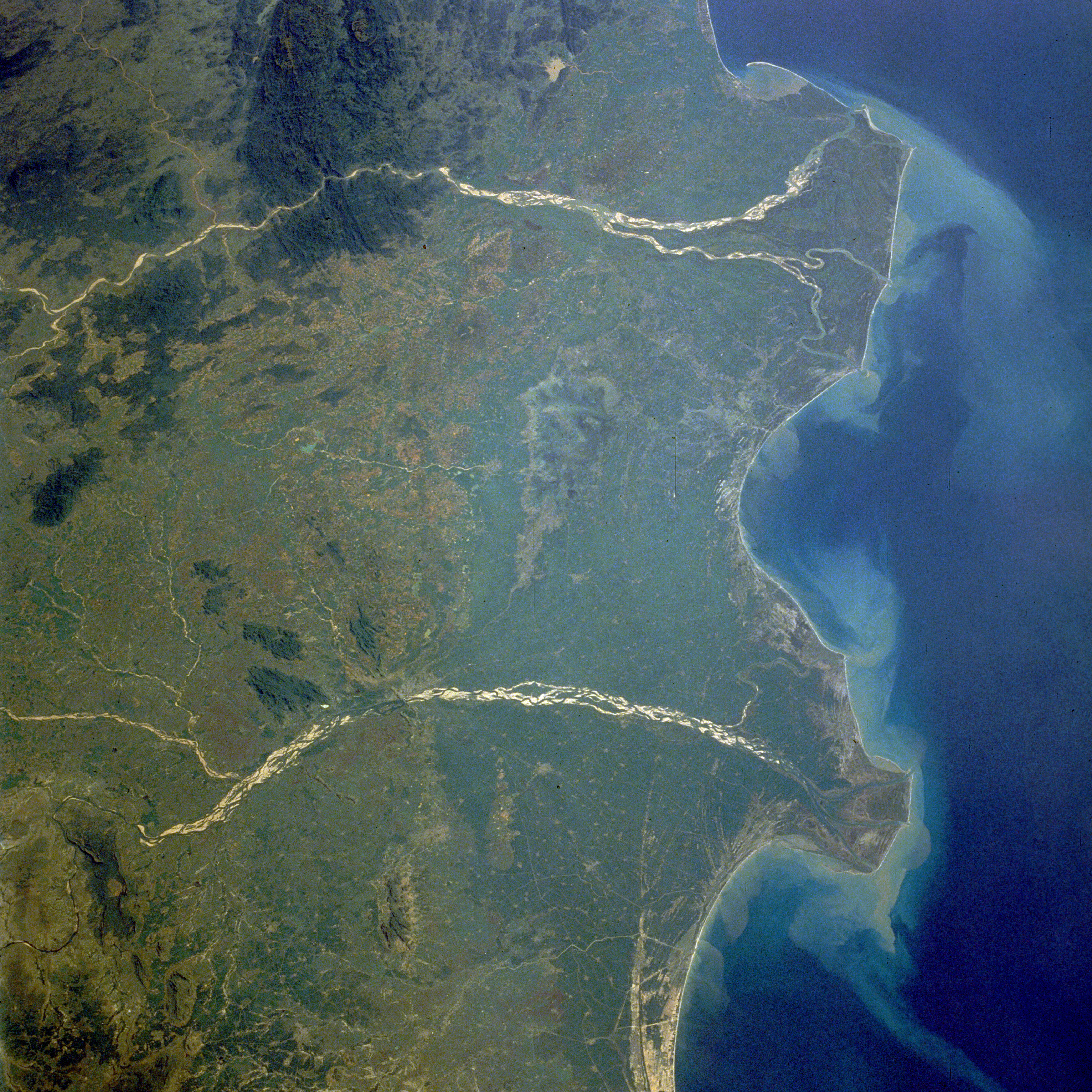
Description: Godavari and Krishna River Deltas in South India — the mouths of the Godavari River (northeast; upper in image) and the Krishna River (southwest, lower in image) empty into the Bay of Bengal in this low-oblique, northwest-looking photograph (October 1989). The two rivers have several common characteristicsâthey are quite wide and have conspicuous deltas, both have heavy discharges of water during the monsoon season (June to early September) followed by low discharges during the dry season (October through late May), both discharge sediment into the Bay of Bengal, and both are sacred rivers of the Hindu religion.The Godavari River — 900 miles (1450 kilometers) long, rises in the Western Ghats and flows across the Deccan Plateau toward the Bay of Bengal in eastern India. Below the city of Rajahmundry, the river divides into two streams that form the huge delta named Pasarlapudi, which is the site of some of the earliest European settlements in India. The Krishna River — more than 800 miles (1290 kilometers) long, also rises in the Western Ghats only 40 miles (64 kilometers) from the Arabian Sea. The river also traverses the Deccan Plateau and empties into the Bay of Bengal southwest of the Godavari River Delta.
Title: Godavari satellite view
Credit: http://earth.jsc.nasa.gov/scripts/sseop/photo.pl?mission=STS034&roll=77&frame=29 Transferred from fr.wikipedia to Commons by Korrigan using CommonsHelper.
Author: Earth Sciences and Image Analysis, NASA-Johnson Space Center. 16 Sep. 2004. "Earth from Space"
Usage Terms: Public domain
License: Public domain
Attribution Required?: No
Image usage
The following page links to this image:
