
Image: Gough Map Birmingham
No higher resolution available.
Gough_Map_Birmingham.jpg (611 × 403 pixels, file size: 270 KB, MIME type: image/jpeg)
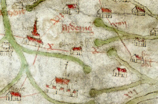
Description: Birmingham illustrated on the fourteenth century Gough Map, shown within the Forest of Arden on the orad between between Lichfield (left) and Droitwich (right)
Title: Gough Map Birmingham
Credit: Gough_Kaart_(hoge_resolutie).jpg
Author: Gough_Kaart_(hoge_resolutie).jpg: Unknown derivative work: JimmyGuano (talk)
Usage Terms: Public domain
License: Public domain
Attribution Required?: No
Image usage
The following 2 pages link to this image:

All content from Kiddle encyclopedia articles (including the article images and facts) can be freely used under Attribution-ShareAlike license, unless stated otherwise.