
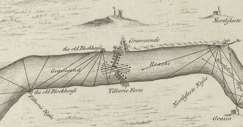
Image: Gravesend defences 1588 Thamesis Descriptio
No higher resolution available.
Gravesend_defences_1588_Thamesis_Descriptio.png (797 × 416 pixels, file size: 481 KB, MIME type: image/png)
Description: Defences of Gravesend and Tilbury. From the 1588 Thamesis Descriptio map. Reversed: North in the bottom!
Title: Gravesend defences 1588 Thamesis Descriptio
Credit: British Library
Author: Surveyor: en:Robert Adams (architect) (1540–1595)
Usage Terms: Public domain
License: Public domain
Attribution Required?: No
Image usage
The following 4 pages link to this image:

All content from Kiddle encyclopedia articles (including the article images and facts) can be freely used under Attribution-ShareAlike license, unless stated otherwise.