
Image: Greenville-Spartanburg-Anderson CSA
No higher resolution available.
Greenville-Spartanburg-Anderson_CSA.png (541 × 437 pixels, file size: 41 KB, MIME type: image/png)
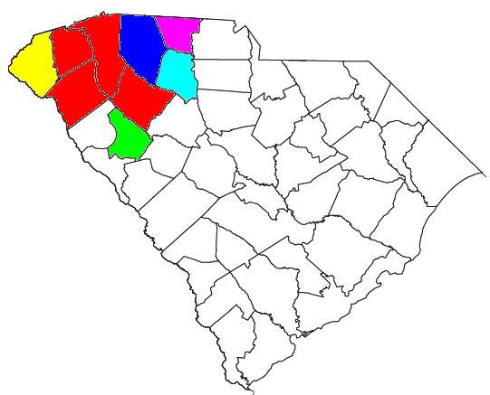
Description: Locator map of the Greenville-Spartanburg-Anderson, SC CSA in the northwestern part of the U.S. state of South Carolina. The Five components of the CSA are colored separately: Red: Greenville-Anderson-Mauldin MSA Blue: Spartanburg MSA Light Green: Greenwood μSA Yellow: Seneca μSA Light Purple: Gaffney μSA
Title: Greenville-Spartanburg-Anderson CSA
Credit: Modified from this United States Census Bureau file, based on this Census definitions list.
Author: Nyttend and Yassie
Permission: The original modification by Nyttend is released into public domain. I hereby release my modification into public domain too.
Usage Terms: Public domain
License: Public domain
Attribution Required?: No
Image usage
The following page links to this image:

All content from Kiddle encyclopedia articles (including the article images and facts) can be freely used under Attribution-ShareAlike license, unless stated otherwise.