
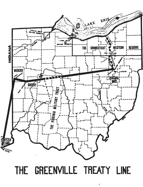
Image: Greenville Treaty Line Map
Size of this preview: 459 × 600 pixels. Other resolutions: 184 × 240 pixels | 544 × 711 pixels.
Original image (544 × 711 pixels, file size: 79 KB, MIME type: image/png)
Description: the line separating White and Indian lands determined at the en:Treaty of Greenville
Title: Greenville Treaty Line Map
Credit: Peters, William E. (1918) Ohio Lands and Their Subdivisions, W.E. Peters, p. 98
Author: William E. Peters
Usage Terms: Public domain
License: Public domain
Attribution Required?: No
Image usage
The following 5 pages link to this image:

All content from Kiddle encyclopedia articles (including the article images and facts) can be freely used under Attribution-ShareAlike license, unless stated otherwise.