
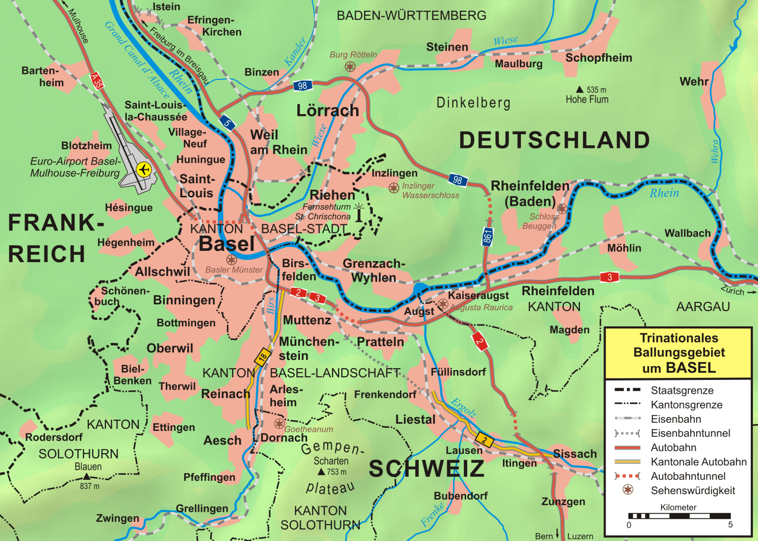
Image: Grossraum Basel
Size of this preview: 800 × 571 pixels. Other resolutions: 320 × 228 pixels | 1,486 × 1,061 pixels.
Original image (1,486 × 1,061 pixels, file size: 1.28 MB, MIME type: image/png)
Description: Topographische Karte vom Großraum Basel
Title: Grossraum Basel
Credit: own work, used: Google Maps-For-Free SRTM3 Webserver OpenStreetMap Webserver Demis Webserver Karte Kanton Baselland.png Karte Kanton Baselstadt.png
Author: first version by Wladyslaw Sojka, complete reworked version by Lencer
Usage Terms: Creative Commons Attribution-Share Alike 3.0
License: CC BY-SA 3.0
License Link: http://creativecommons.org/licenses/by-sa/3.0
Attribution Required?: Yes
Image usage
The following 4 pages link to this image:

All content from Kiddle encyclopedia articles (including the article images and facts) can be freely used under Attribution-ShareAlike license, unless stated otherwise.