
Image: Gulf Coast Platforms
No higher resolution available.
Gulf_Coast_Platforms.jpg (600 × 399 pixels, file size: 168 KB, MIME type: image/jpeg)
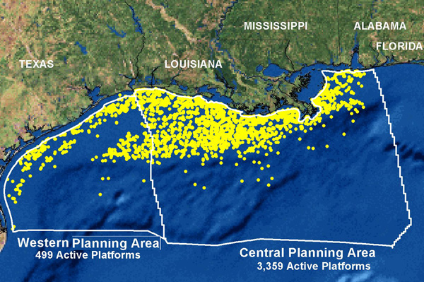
Description: Map of the northern Gulf of Mexico showing the nearly 4,000 active oil and gas platforms.
Title: Gulf Coast Platforms
Credit: Oil and Gas Exploration on the NOAA Ocean Explorer site
Author: Ocean Explorer Webmaster
Permission: Copyright FAQ; see also image page which specifies no other copyright
Usage Terms: Public domain
License: Public domain
Attribution Required?: No
Image usage
The following 2 pages link to this image:

All content from Kiddle encyclopedia articles (including the article images and facts) can be freely used under Attribution-ShareAlike license, unless stated otherwise.