
Image: Gwynedd 1247 Map

Size of this preview: 800 × 600 pixels. Other resolutions: 320 × 240 pixels | 960 × 720 pixels.
Original image (960 × 720 pixels, file size: 70 KB, MIME type: image/jpeg)
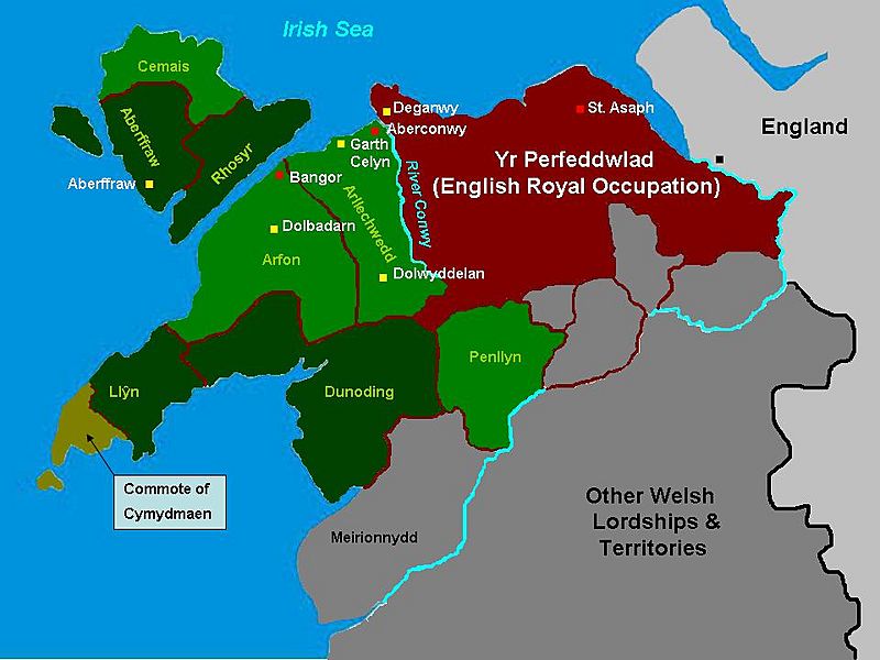
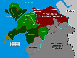
Description: The situation in Gwynedd following the division of 1247 on map of the cantrefi, principal forts and political centres of Gwynedd at the kingdom's maximum extent, based on the historic borders of "between Dyfi and Dee". Map based on freeware outline from welshgraphics.com. I have used the maps found in J.Beverley Smith's "Llywelyn ap Gruffudd" (1998) as a visual guide. It has taken me days.
Title: Gwynedd 1247 Map
Credit: Own work
Author: James Frankcom (talk)
Usage Terms: Creative Commons Attribution-Share Alike 3.0
License: CC BY-SA 3.0
License Link: https://creativecommons.org/licenses/by-sa/3.0
Attribution Required?: Yes
Image usage
The following 2 pages link to this image:

All content from Kiddle encyclopedia articles (including the article images and facts) can be freely used under Attribution-ShareAlike license, unless stated otherwise.